OUR EXPERTISE

HARDWARE
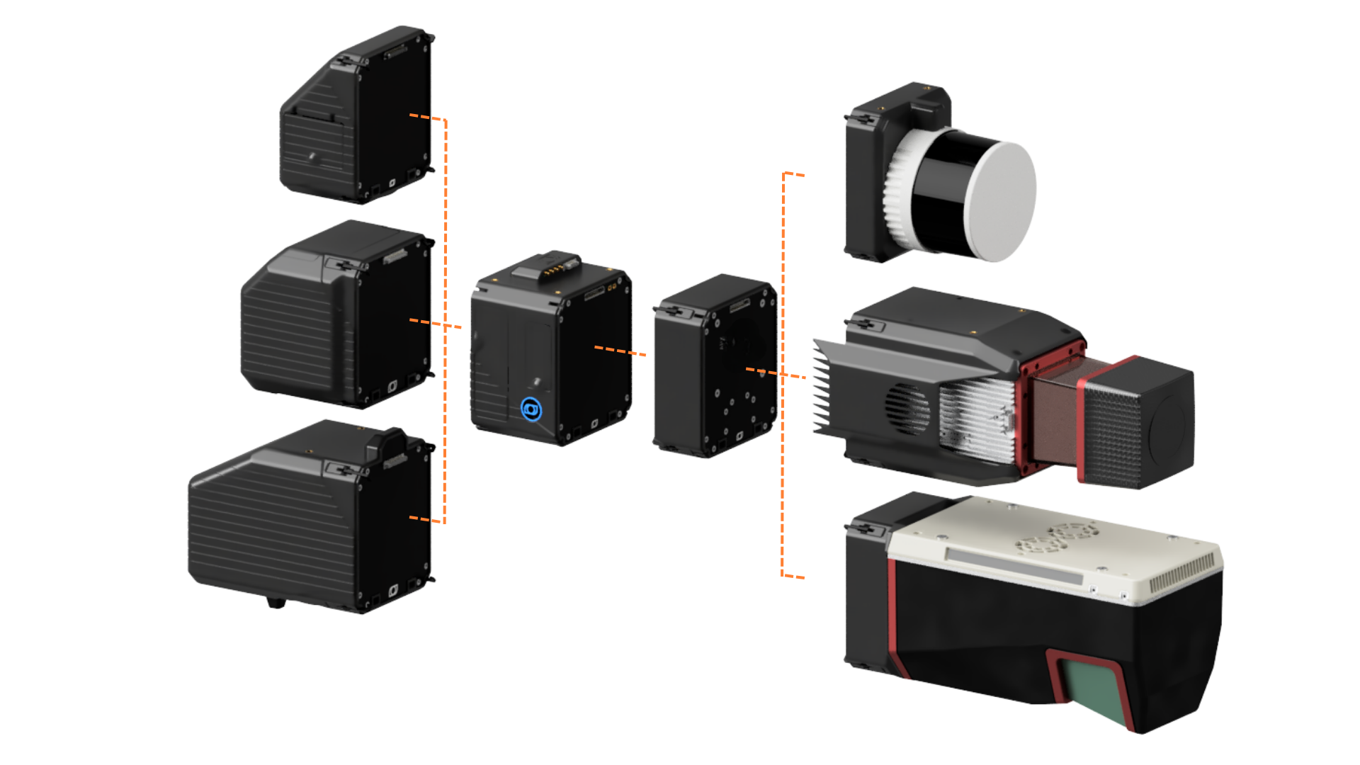
Balko’s Connectiv modular geospatial data sensor is entirely designed and manufactured at our headquarters in Quebec City, Canada. It integrates the industry’s highest-performing sensors into a unique system that allows for the combination of various LiDAR, INS, and camera modules into a single system. Obtaining point clouds and orthophotos in a single flight is now possible.
SOFTWARE
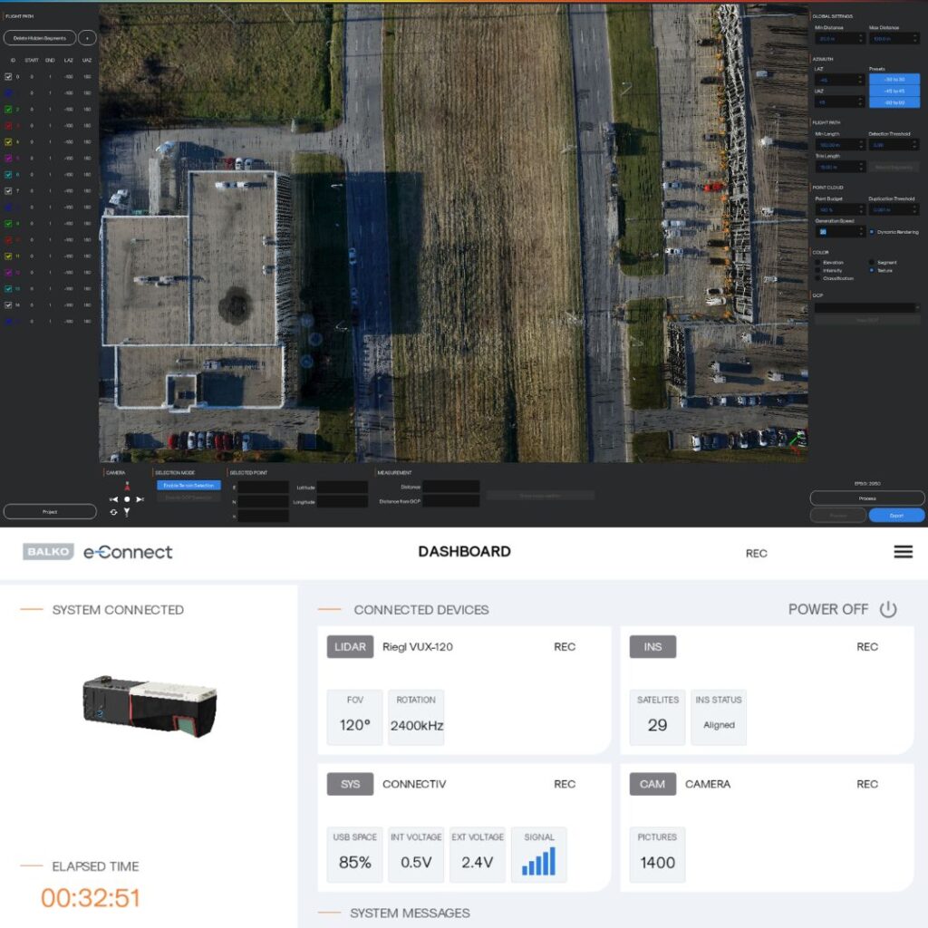
Balko develops software that ensures the Connectiv system functions correctly during missions and processes data generated by various sensors in a single step. This synchronization optimizes workflows by combining all data and reduces licensing costs by using fewer technological tools.
TRAINING
Our clients benefit from training to make sure they quickly master the sensor and its software in order to integrate them efficiently and rapidly into their operations.
CONFIGURE CONNECTIV FOR YOUR MISSION
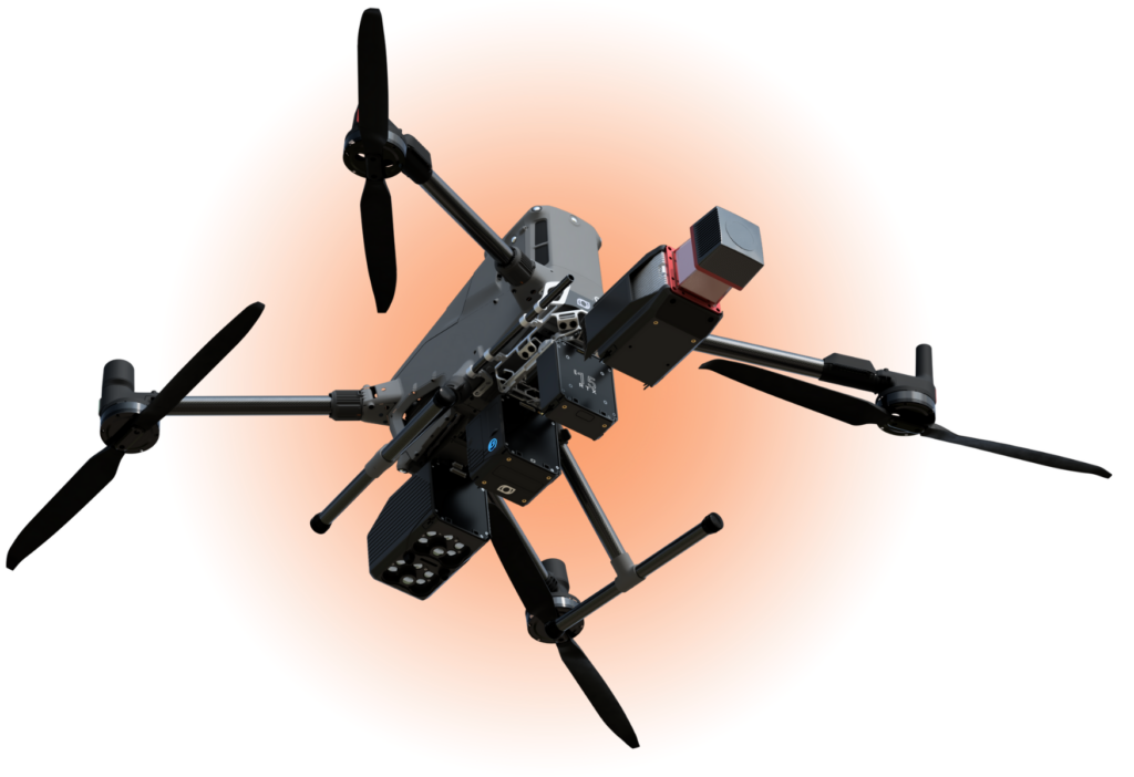
Our flagship product, Connectiv, is a modular geospatial data sensor for drones that allows you to connect various LiDAR, camera, and INS modules.
At the heart of this system is a compact and robust computer that manages your acquisition data. It is to this computer that you connect the essential components for your mission: the inertial navigation system (INS) best suited to your needs, as well as the LiDAR and camera modules best suited to the images you wish to generate.
INDUSTRIES
ABOUT BALKO
Born on the field
We are aligned with you because we have been in your shoes.
After years of experience as a geomatics specialist, capturing and processing aerial data with drones, our founder, Maude Pelletier, decided to create a solution to address the operational challenges she repeatedly faced:
- Managing multiple systems, multiplying data sources;
- The difficulty of merging and processing data from various sensors, requiring the use of multiple software programs;
- The inability to adjust sensor configurations to meet the specific needs of each mission.
Since no existing tool met her requirements, she decided to create this solution, now called Connectiv.
This modular sensor system connects a variety of LiDAR, camera, and INS modules to a central computer, configurable for a wide range of missions. It’s lightweight, versatile across many drone platforms, and designed to perform in environments where other systems fall short.
Connectiv allows you to accomplish in a few days what previously took weeks.

FAQ
LiDAR (Light Detection and Ranging) is a remote sensing technology that uses laser pulses to measure distances with extreme precision. By emitting laser beams and analyzing their reflections, LiDAR generates highly detailed 3D maps of landscapes, structures, and objects.
Balko Tech’s Connectiv LiDAR scanner takes this technology even further with its modular and adaptable design. Unlike fixed LiDAR systems, Connectiv allows users to change sensors, INS, or cameras, adapting to diverse mission needs without replacing the entire system. Its seamless integration with various drone platforms ensures maximum flexibility, accuracy, and efficiency for aerial mapping and data collection. Furthermore, Connectiv is designed to work with Balko Tech’s proprietary software (e-las, e-connect), optimizing workflows from data acquisition to processing. This makes it an ideal solution for professionals seeking versatile and future-proof LiDAR technology.
The Connectiv modular sensor enhances the accuracy of aerial surveys and mapping by combining high-resolution laser scanning, advanced positioning technology, and an adaptable modular design. Thanks to its interchangeable modules, users can select the most suitable LiDAR sensor, INS, or camera for each mission, ensuring optimal accuracy across diverse terrains and conditions. Integrated with a high-precision GNSS and IMU, Connectiv produces detailed, georeferenced 3D point clouds with minimal error. Furthermore, its full compatibility with Balko Tech’s e-Las and e-Connect software optimizes data processing for high-quality mapping results. With Connectiv, professionals benefit from exceptional LiDAR sensor accuracy for reliable and efficient geospatial data collection.
The Connectiv system offers unparalleled versatility for LiDAR scanning, making it a valuable tool for numerous industries. Its modular design and compatibility with various drones allow professionals to adapt to diverse requirements while maintaining high-precision data acquisition. Key sectors that benefit include:
- Geomatics and Mapping: Capturing high-resolution 3D terrain models with optimal accuracy.
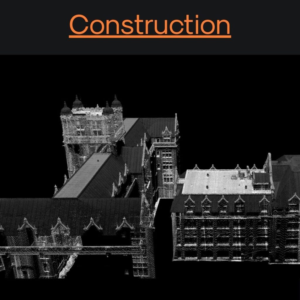
- Construction and Infrastructure: Monitoring work progress, analyzing sites, and improving planning.
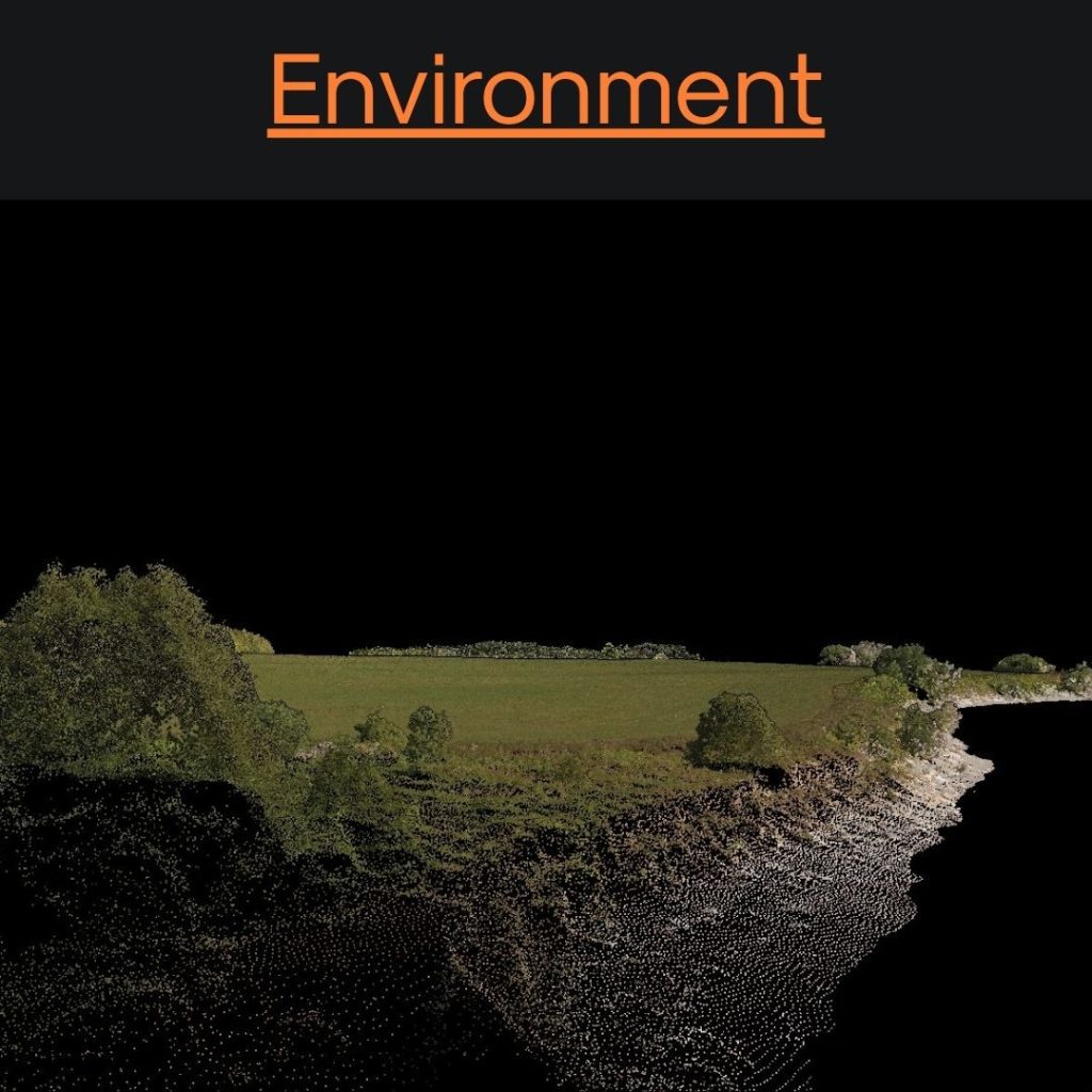
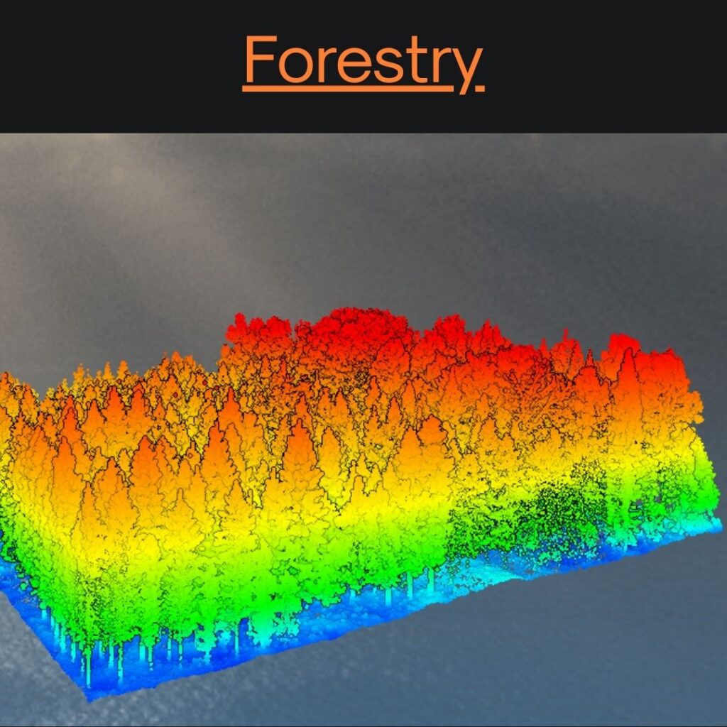
- Forestry and Environmental Monitoring: Assessing vegetation, calculating biomass, and tracking environmental changes.
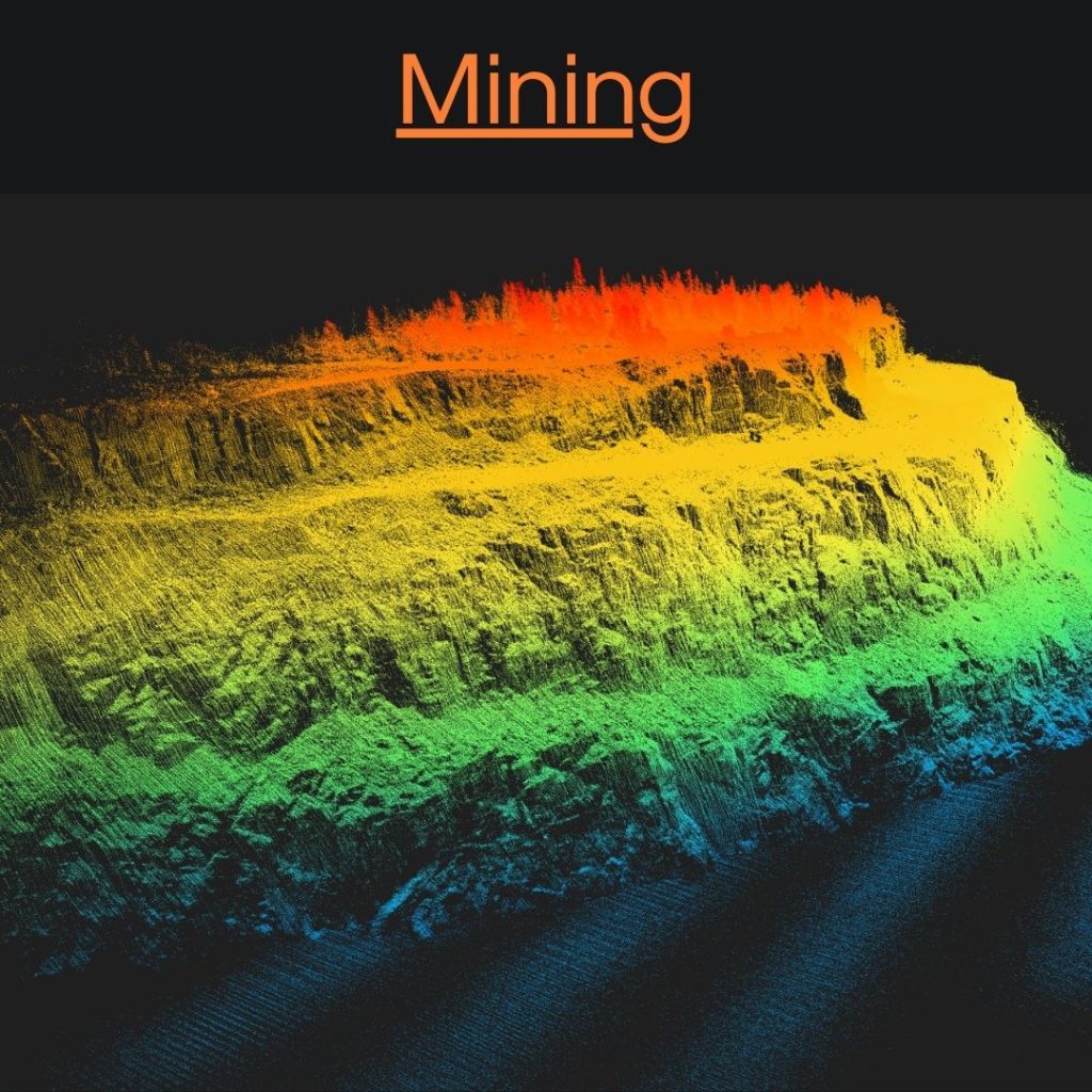
- Mining and Quarrying: Optimizing resource management and conducting safe and efficient surveys.
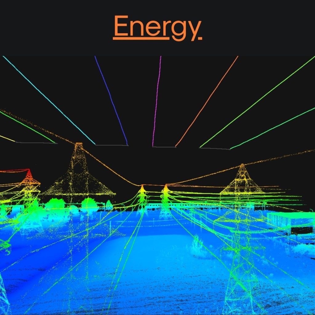
- Utilities and Energy: Inspecting power lines, pipelines, and infrastructure with detailed LiDAR scanning.
- Government and Research: Supporting geospatial studies, urban planning, and emergency management.Thanks to Connectiv’s adaptable LiDAR technology, professionals in all these sectors can collect data efficiently, accurately and scalably, which improves decision-making and operational efficiency.
The Connectiv system takes LiDAR technology to the next level with its modular design, allowing professionals to easily replace components such as the laser sensor, inertial navigation system (INS), or camera to create customized configurations for a variety of applications. This flexibility ensures precise adaptation to the specific requirements of each project, whether it’s high-precision terrain mapping, infrastructure inspection, or environmental monitoring. By offering the ability to adjust system components based on terrain, altitude, or data accuracy requirements, Connectiv provides a versatile solution for industries such as geomatics, mining, and forestry. Integration with Balko Tech’s e-las and e-connect software further optimizes workflows, making data processing more efficient while maintaining exceptional accuracy for a wide range of use cases.003e
Yes, the Connectiv modular sensor is fully customizable to meet the specific needs of each project. Thanks to its modular design, users can replace essential components, such as the laser sensor, the INS (Inertial Navigation System), and the camera, to create configurations tailored to mission requirements. Whether for high-resolution geomatics data acquisition, infrastructure inspection, or environmental monitoring, the Connectiv LiDAR adapts to different terrain types, required accuracy levels, and project scopes. This flexibility ensures versatility, delivering optimal performance for a wide range of industries and applications while maintaining exceptional accuracy and efficiency.
The Connectiv geospatial data sensor stands out for its exceptional efficiency and data accuracy thanks to its modular design and the integration of cutting-edge technologies. By allowing users to interchange LiDAR sensors, INS units, and cameras, Connectiv optimizes each project to meet its specific requirements, improving both the speed and accuracy of operations. Its high-resolution laser scanning technology captures detailed and precise point clouds with minimal noise, while integration with Balko Tech’s e-las and e-connect software simplifies data processing and reduces post-processing time. Furthermore, seamless compatibility with multiple drone platforms offers maximum operational flexibility, enabling faster deployment and improved performance, even in complex environments. This combination of modularity and advanced technologies makes Connectiv a benchmark solution for accurate and efficient LiDAR data collection.
Latest news
Quebec, Canada — Balko and ARA Robotics announce the signing of a strategic partnership...