In aerial mapping, two advanced technologies stand out: LiDAR (Light Detection and Ranging) and photogrammetry. Both produce precise spatial data but rely on different physical principles and processing methods. This distinction directly influences the quality of deliverables, the types of projects targeted, and the optimal conditions for use.
Two Complementary Technological Approaches
LiDAR is an active technology that emits high-frequency laser pulses (which can exceed 2 million per second) towards the ground. Each return is recorded with precise 3D coordinates, often enriched by signal intensity and other attributes. LiDAR can record multiple echoes per pulse, allowing differentiation between the canopy, understory, and ground.
Photogrammetry relies on RGB or multispectral images. Processing is based on pixel correlation between photos to generate dense point clouds and surface models. It requires high-resolution images (e.g., 20 MP or more per sensor) and meticulous flight planning to ensure optimal overlap.
By nature, LiDAR produces three-dimensional data that can be processed almost in real-time. It offers high absolute altimetric accuracy and can even capture data through vegetation. Photogrammetry, while enabling the reconstruction of 3D models from surface images, is used to produce georeferenced 2D images. These geometrically corrected orthophotos are highly valued for their visual clarity and ease of interpretation.
Photogrammetry and Orthophotography: Two Concepts Not to Be Confused
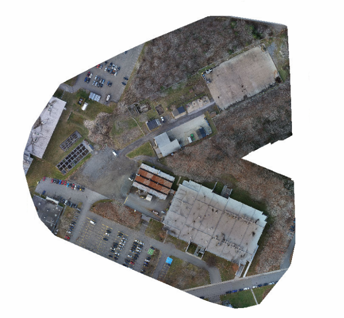
It’s important to distinguish orthophotography from photogrammetry, even though the two are closely related. Orthophotography involves producing georeferenced 2D images corrected to eliminate perspective and relief effects. Each pixel in an orthophoto thus represents an exact ground position, making it a widely used cartographic product for visual analysis, planning, or inventory.
Photogrammetry, on the other hand, is the method that goes beyond the image: it uses series of photos taken from different angles to extract three-dimensional spatial information. This image correlation process allows the reconstruction of shapes, volumes, and elevations from visual data. In other words, the orthophoto is a final 2D product, while photogrammetry is a processing method that transforms these images into 3D models, point clouds, or digital surfaces, depending on the project’s objectives.
Differing Results Based on the Method
The results produced by LiDAR are generally highly precise point clouds, even in complex environments like forests, industrial structures, or mountainous areas. The data is less sensitive to ambient light. Photogrammetry allows for the production of highly detailed orthophotos and visually rich 3D models. It excels in visualizing structures and textures but may have limitations in the presence of dense vegetation or homogeneous surfaces (snow, water, black asphalt).
- Absolute Altimetric Accuracy
- LiDAR: ±2 to ±5 cm, even under vegetation.
- Photogrammetry: ±5 to ±20 cm, depending on texture, GSD, and georeferencing.
- Data Resolution
- LiDAR: Density of 50 to 500 points/m² depending on altitude, speed, and system used.
- Photogrammetry: Often higher point density (up to 1,000 points/m²), but less homogeneous and less reliable vertically.
- Acquisition Capacity
- LiDAR enables rapid campaigns over very large areas (several tens of km² per flight). It can be used in shaded areas and even at night.
- Photogrammetry requires good lighting conditions and is more sensitive to shadows and lighting variations.
Generating 3D Models with Photogrammetry
Producing a 3D model using photogrammetry is a structured process that relies both on rigorous image acquisition and advanced computer processing. The first step involves capturing a series of images of the same scene from multiple angles, with significant overlap between shots. Once the images are collected, specialized software detects common points across the photos to determine the camera’s position in space. This step makes it possible to reconstruct a three-dimensional point cloud, which is then used to create a continuous surface (called a mesh), onto which the original photo textures are applied.
This process requires substantial computing resources, especially when modeling large areas or those with a high level of detail. It is also sensitive to surface quality: homogeneous textures such as water, snow, or dark asphalt complicate reconstruction and can lead to precision losses or artifacts in the final model. While photogrammetry does enable the generation of three-dimensional objects, these models are often limited in terms of vertical accuracy and reliability in complex environments.
For this reason, LiDAR remains, in most professional contexts, the most robust method for producing reliable, consistent, and usable 3D models,particularly in civil engineering, surveying, and environmental applications. Photogrammetry nonetheless retains an essential role in producing accurate and easy-to-interpret orthophotos, which are especially valuable for site monitoring, visual inventory, and project communication.
Applications Suited to Aerial Data Collection
In the context of aerial imaging, the chosen technology depends on the project’s objectives. For high-precision topographic surveys, especially in forested areas or along extensive linear corridors, LiDAR is often the preferred option. It is fast, reliable, and provides usable data even over rugged terrain.
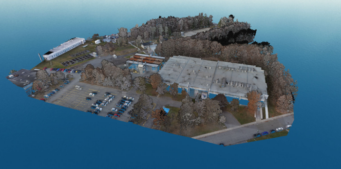
Aerial photogrammetry is ideal for mapping urban areas, monitoring construction progress, or documenting infrastructure. It is more cost-effective to deploy, especially over smaller areas, and produces visual renderings that are easy to interpret for non-specialists.
Practical Applications of LiDAR
Forest mapping and vegetation canopy management
Context: Forest inventory, ecosystem modeling, and silvicultural planning.
Why use LiDAR: It captures not only the canopy but also internal forest structures (understory) and the ground beneath dense vegetation thanks to multiple returns.
Examples
- Automated measurement of tree height, crown diameter, and trunk circumference across entire forest stands.
- Estimation of above-ground biomass and detection of canopy gaps.
- Detection of forest trails or areas of natural regeneration that are difficult to see with the naked eye.
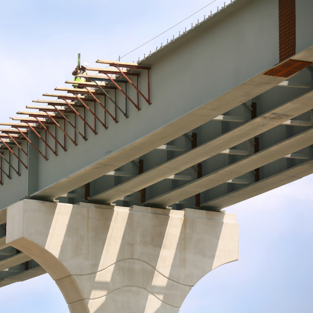
Surveying linear corridors: roads, power lines and pipelines
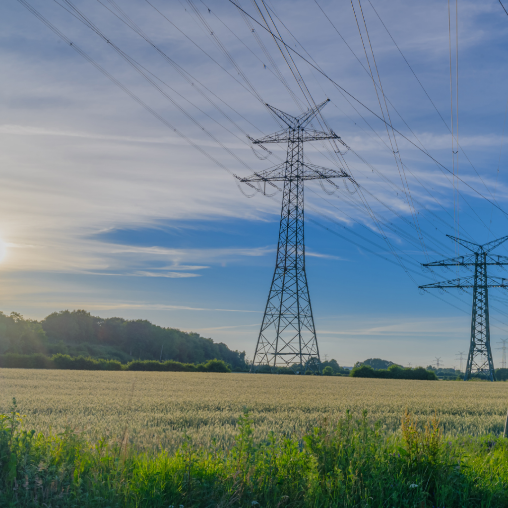
Context: Construction, maintenance, or planning of linear infrastructure.
Why use LiDAR: It quickly covers long distances with consistent accuracy, even over rugged terrain or through vegetation.
Examples
- Classification, vectorization, and inspection of hydroelectric infrastructure.
- Analysis of vegetation encroachment.
- Creation of terrain models along roadways to assess slopes and drainage ditches.
- Surveying high-voltage line rights-of-way with clearance calculations.
- Detection of subsidence or ground movement near pipelines.
Analysis of mining sites or inaccessible areas
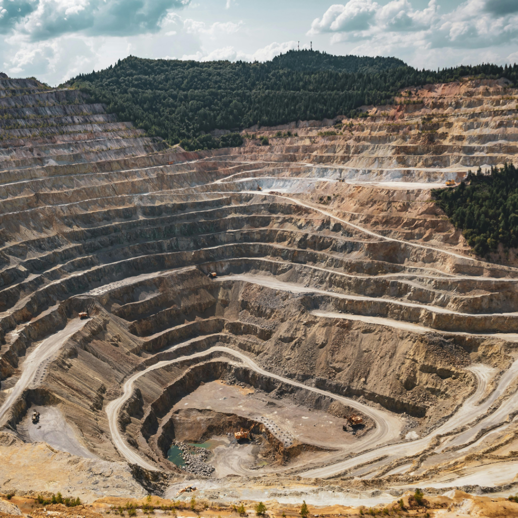
Context: Worker safety, operational monitoring, or modeling of extracted volumes.
Why use LiDAR: It enables rapid surveying without ground intervention, even in unstable or hazardous environments.
Examples
- Monitoring of active quarry faces.
- Detection of recent landslides or erosion on steep slopes.
- Calculation of extracted volumes or earthworks by comparing two successive surveys.
Practical Applications of Photogrammetry
Site monitoring and progress documentation

Context: Building construction, land development, large-scale infrastructure projects.
Why use photogrammetry: It enables the production of orthophotos at regular intervals and generates models that are easy to understand for all stakeholders.
Examples
- Weekly comparison of progress on a highway construction site.
- Visual documentation of key stages for compliance reporting.
- Integration of models into BIM platforms to compare as-built data with design plans.
Infrastructure inspection
Context: Preventive maintenance or infrastructure diagnostics.
Why use photogrammetry: High-resolution imagery makes it possible to detect fine details on structures.
Examples
- Visual inspection of heritage building façades to identify cracks.
- Detection of deformations on bridges or pylons without direct human intervention.
- Assessment of a dam’s condition using a colorized 3D model.
Urban mapping and land-use planning
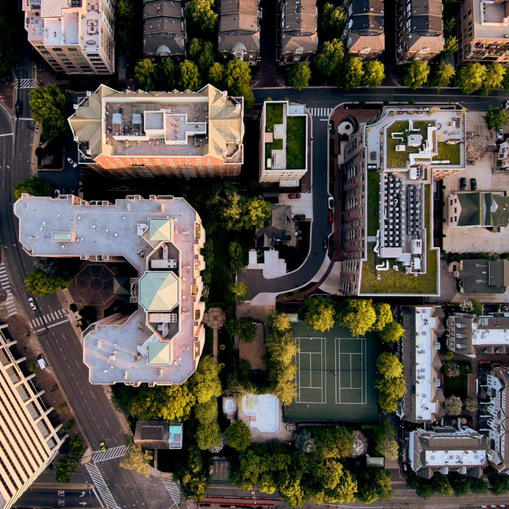
Context: Urban planning, decision-making tools.
Why use photogrammetry: It provides realistic, navigable models that support communication and simulation efforts.
Examples
- Simulation of shading cast by future buildings at different times of day.
- Visualization of urban heat islands by combining photos with thermal imagery.
- Integration into 3D GIS platforms for zoning, height analysis, or transport corridor planning.
What About Acquisition Costs?
The choice between LiDAR and photogrammetry has budgetary implications that directly affect return on investment. LiDAR involves a higher upfront investment, with professional-grade sensors typically ranging from $50,000 to $200,000. This is in addition to the technical expertise required for data post-processing. However, the technology offers a highly competitive cost per square kilometer for large-scale projects, particularly in complex environments such as dense forests, linear corridors, or rugged terrain. It enables the classification and automation of both natural and man-made landscape elements. Its ROI is especially strong for recurring mandates that require high vertical accuracy, such as legal surveying, infrastructure monitoring, or forest management.
Photogrammetry relies on less expensive equipment: high-quality RGB or multispectral cameras can be acquired for a few thousand dollars. It is an ideal solution for companies or municipalities looking to produce orthophotos or 3D models that don’t require extreme precision—at a lower cost. The ROI is particularly advantageous for short-term projects, frequent visual monitoring (such as construction or inspection), or visualization needs intended for non-technical audiences.
Combining LiDAR and Photogrammetry for Optimal Results
More and more projects are combining both approaches. LiDAR provides a solid geometric foundation that is independent of lighting conditions, while photogrammetry adds color, texture, and visual context. This synergy is particularly powerful in aerial missions, where onboard space makes it possible to mount both a LiDAR module and an RGB or multispectral camera.
This type of integration enhances the quality of deliverables, optimizes data collection campaigns, and supports better decision-making—especially in the fields of surveying, civil engineering, land-use planning, and environmental management.

This is precisely the logic behind Balko Tech’s Connectiv system, which was designed with this integrated approach in mind. Its modular platform allows users to combine a LiDAR sensor with one or more cameras for photogrammetry on a single mount. Thanks to this native compatibility between the two technologies, users can easily capture dense geometric data while generating rich visual outputs.
In the context of aerial data collection, this integrated approach reduces flight time, enhances the overall accuracy of results, and maximizes the value of each mission.
Comparative Summary of LiDAR and Phtogrammetry
| LiDAR | Photogrammetry | |
| Data Collection | – Active technology (laser emission). – Operates day and night. – Less dependent on light and contrast. – Penetrates vegetation. – Fast coverage of large, complex areas. | – Passive technology (image capture). – Depends on natural light. – Requires strong overlap (70–85%). – Less effective on uniform or shiny surfaces. – Sensitive to weather conditions. |
| Data Attributes | – Very dense 3D point clouds. – Accurate elevation data. – Excellent geometric reliability. – Can generate digital terrain and surface models. | – High-resolution orthophotos. – Colorized 3D models. – Strong visual rendering for inspection. – Elevation is less reliable on low-texture surfaces. |
| Absolute Altimetric Accuracy | ±2 to ±5 cm, even under vegetation. | ±5 to ±20 cm, depending on texture, GSD, and georeferencing. |
| Data Resolution | – Point density of 50 to 500 pts/m² depending on altitude, speed, and system used. | – Often higher point density (up to 1,000 pts/m²), but less consistent and less reliable in vertical measurements. |
| Acquisition Capacity | – Ideal for long or technically complex missions. | – Best suited for short missions or urban areas. |
Choosing the Right Combination
Understanding the technical differences between LiDAR and photogrammetry, in terms of accuracy, data density, output formats, as well as software and financial resources, is essential to guiding the right technology choice. Today, combining both approaches offers a robust, versatile, and strategic solution to produce reliable digital twins, optimize planning, and support decision-making in a variety of contexts.
The team at Balko Tech stands out for its field expertise in LiDAR data capture and aerial imaging for photogrammetry. We’ll be happy to help you select the best possible configuration to meet the specific requirements of your projects. Contact us today!
Other news
Éducation
29 July 2026
Technological sovereignty
Discover why technological sovereignty influences the choice of geospatial solutions in...