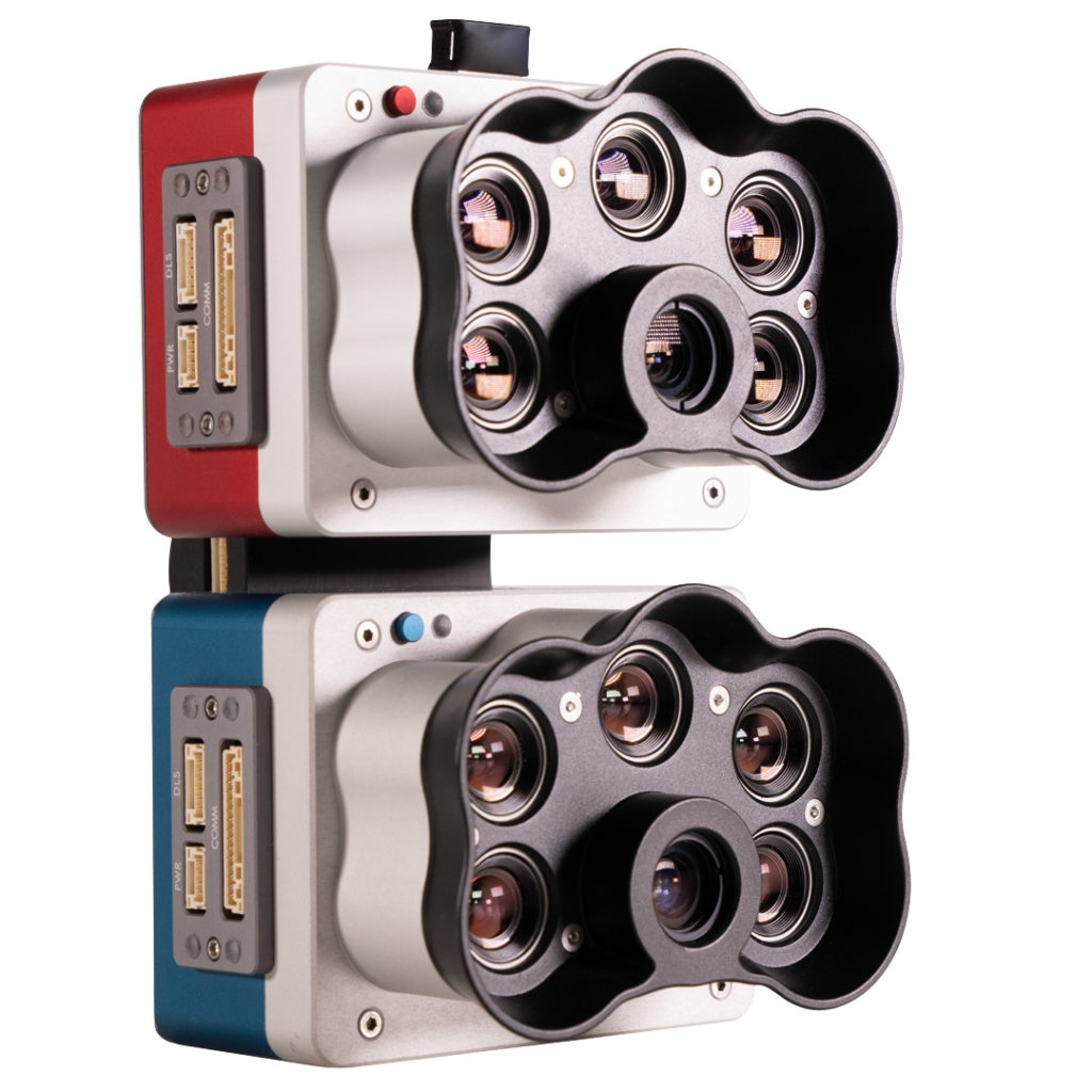
At Balko Tech, innovation often starts with a real-world challenge. That’s exactly how our latest configuration, a dual multispectral camera module integrated with Connectiv, came to life. This new setup expands the capabilities of our modular LiDAR platform, offering professionals in environmental research, agriculture, forestry, and land management a powerful new toolset.
Why Dual Multispectral?
Multispectral imaging allows users to capture information beyond the visible spectrum, across specific wavelength bands. In our dual multispectral camera setup, 10 spectral bands are captured, ranging from 400 nm to 900 nm. This includes:
- Shorter UV-A and longer NIR – to support satellite comparison and calibration
- Visible bands (RGB) – for color imagery and visual interpretation
- Red Edge and Near-Infrared (NIR) – for assessing plant health, water stress, and biomass
With this setup, users can analyze not only what’s there, but also how it’s functioning—detecting subtle differences in vegetation types, health indicators, and ecosystem dynamics that aren’t visible to the naked eye.
Real-World Testing with Carleton University
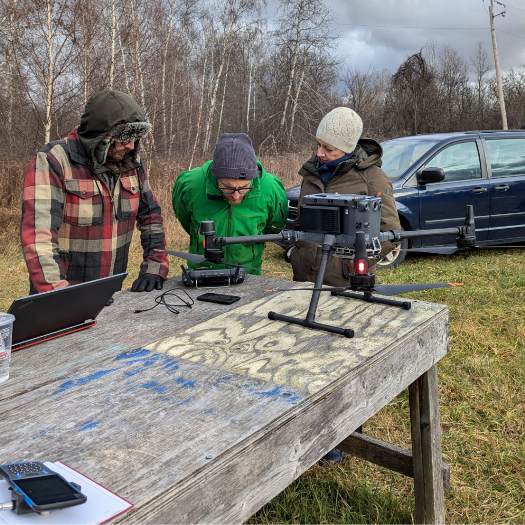
This configuration was first developed in collaboration with Carleton University, where researchers were studying bogs and marshlands across Canada. Their challenge: accurately distinguish between vegetation types, especially Sphagnum mosses and other peatland species, in remote areas where satellite resolution falls short.
Their approach combined:
- LiDAR for canopy structure, elevation, and surface modeling
- Multispectral imaging for assessing chlorophyll content, photosynthetic activity, and vegetation stress
Initially, the two multispectral cameras were externally mounted beneath the Connectiv payload. Field testing confirmed the setup’s value, but also revealed opportunities for improvement. Based on feedback, we redesigned the configuration to integrate both cameras into the Connectiv housing—enhancing protection, simplifying installation, and streamlining field swaps.
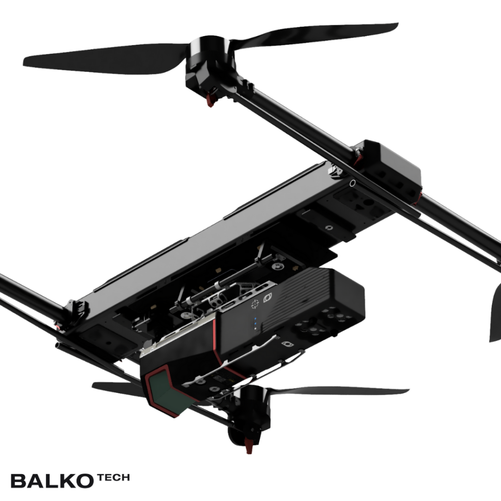
Technical Overview of the Setup
- Camera Integration: Dual cameras mounted internally, protected within the Connectiv enclosure.
- Spectral Coverage: 10 bands across the visible to NIR spectrum (400–900 nm).
- Swappable Modules: Quick-switch design enables fast transitions between RGB and multispectral payloads.
- Data Fusion Compatibility: Synchronizes with LiDAR data acquisition to support geospatial fusion and co-analysis.
- Software Tools: Compatible with Balko’s e-Las and e-Connect for mission planning, georeferencing, and spectral analysis.
Applications Across Sectors
This new configuration unlocks a wide range of possibilities across industries:
- Environmental Monitoring: Track plant species dynamics, wetland health, invasive species, and climate-sensitive habitats.
- Agriculture: Assess crop health, optimize irrigation, detect disease outbreaks, and improve yield forecasting.
- Forestry: Map tree species, monitor regeneration, detect deforestation or stress zones.
- Land Management: Support reforestation programs, habitat conservation, and carbon offset verification.
Field-Ready Flexibility
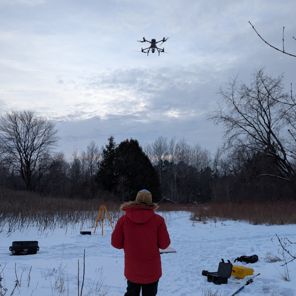
Thanks to Connectiv’s modular design, researchers at Carleton—and future users—can now switch from a standard RGB camera to the dual multispectral module directly in the field. This flexibility is crucial for multi-purpose missions, allowing teams to adapt to changing goals or environments without downtime.
“We work in remote, hard-to-access areas, so drones are essential tools for our research. The landscapes we study are dominated by Sphagnum moss and other unique peatland vegetation. Being able to combine LiDAR with a dual multispectral camera on our drone allows us to efficiently distinguish between different types of vegetation,”
— Koreen Millard, Associate Professor, Department of Geography and Environmental Studies, Carleton University
A Smarter Way to See the Landscape
By combining 3D structural data from LiDAR with spectral insights from multispectral imagery, this new Connectiv configuration provides a richer, more complete view of the landscape. Whether you’re monitoring ecosystem change, managing natural resources, or conducting scientific research, the dual multispectral setup offers precision, versatility, and depth.
Want to explore what this new configuration could do for your organization?
Contact our team to get more informations and request a custom quote.
Other news
Éducation
29 July 2026
Technological sovereignty
Discover why technological sovereignty influences the choice of geospatial solutions in...