Precise measurements and advanced analyses of road networks
Geospatial sensors for drones have transformed the engineering and management of industrial transportation infrastructure. Balko’s modular Connectiv system is designed to integrate laser scanners, inertial navigation units (INS), and specialized cameras into a single compact platform, enabling the collection of detailed and actionable geospatial data during a single flight. This configurability allows for the generation of georeferenced 3D point clouds, orthophotos, and multispectral images, providing a comprehensive foundation for the analysis, modeling, and planning of critical infrastructure.
The collected geospatial data produces georeferenced 3D point clouds that serve as the basis for digital infrastructure modeling. These detailed models allow for the measurement, visualization, and analysis of structural or environmental elements with exceptional accuracy, facilitating the integration of results into Geographic Information Systems (GIS) and Building Information Modeling (BIM) workflows for advanced industrial applications.
CONNECTIV APPLICATIONS IN THE TRANSPORTATION INDUSTRY
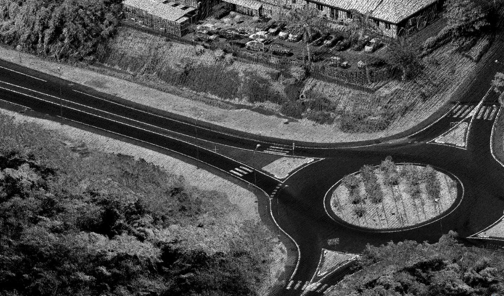
Road surveys and topographic modeling
High-resolution terrain models of the benches, pit walls, and haul roads provide engineers with the data needed to design efficient extraction sequences, optimize blasting, and ensure slope stability. Drones equipped with LiDAR can safely capture information from hazardous or inaccessible areas without interrupting operations.
Frequently use with: XT32/M2X
Ideal for road projects thanks to its excellent compromise between point density, accuracy and wide range.
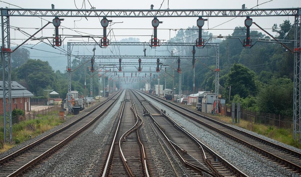
Monitoring and management of railway corridors
Railway operators must monitor long, often difficult-to-access areas while adhering to strict safety regulations. Drone-based LiDAR enables mapping of the entire corridor, measurement of regulatory clearances, detection of invasive vegetation, and identification of potential obstacles near tracks or overhead lines. Photogrammetry complements the analysis with a detailed visualization of the condition of the tracks, sleepers, and adjacent infrastructure, facilitating the planning of maintenance and preventative operations.
Frequently use with: miniVux-3
Perfect for railway corridors thanks to its high precision, compactness and ability to finely capture linear environments.
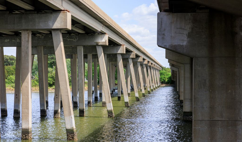
Bridge and viaduct inspection
Bridges, viaducts, and interchanges are critical infrastructure requiring frequent and safe inspections. Drone-based LiDAR captures the complete geometry of structures, including piers, decks, and hard-to-reach vertical surfaces, without scaffolding or traffic disruptions. Photogrammetry provides very high-resolution images to identify cracks, corrosion, or visible defects. The resulting 3D models facilitate structural analysis and monitoring of changes over time.
Frequently use with: VUX-120
Ideal for complex structures thanks to its very high point density and performance on vertical surfaces.
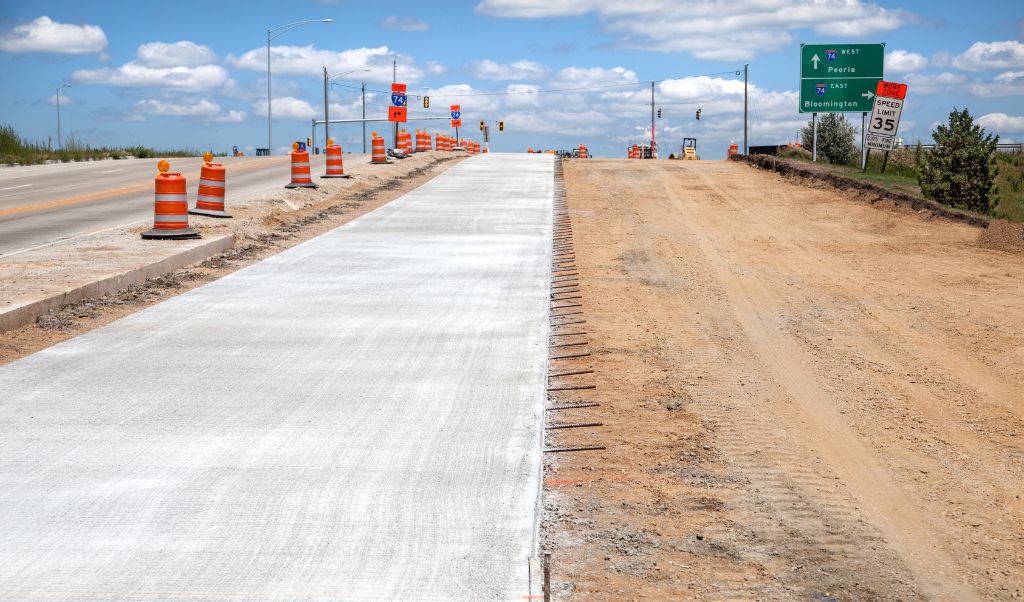
Monitoring of construction sites and calculations of infrastructure volumes
In transportation infrastructure projects, precise progress monitoring is essential to meeting deadlines and budgets. Drone-based LiDAR allows for the accurate measurement of cut and fill volumes, comparison of surfaces at different project stages, and validation of plan compliance. Photogrammetry adds a clear visual dimension for communication between engineers, contractors, and project owners, while documenting the project’s progress.
Frequently use with: XT32/M2X
Ideal for monitoring large-scale construction sites thanks to its high speed and the precision of its volumetric calculations.
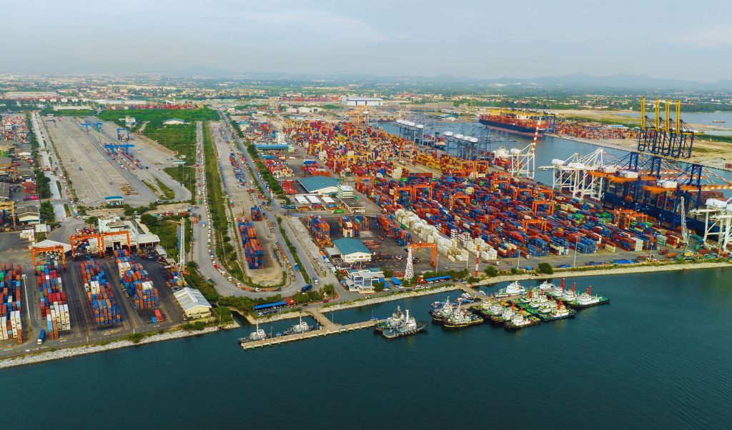
Mapping of logistics corridors and port areas
Port areas and logistics corridors require precise management of flows and access, particularly due to the density of infrastructure and the multiplicity of uses. Geospatial data allows for mapping these areas with fine granularity, facilitating the optimization of operations, platform security, and the planning of infrastructure expansions or modifications.
Frequently use with: miniVux-1/3
Its high point density and ability to capture fine details on varied surfaces are ideal for accurately and efficiently mapping complex logistics environments and extensive port areas.
Do you have a project and want to know how Connectiv can make it happen? Contact us today to learn more about other applications in the transportation industry.
CONFIGURE CONNECTIV FOR YOUR TRANSPORTATION INDUSTRY PROJECTS
Choose the Right LiDAR Module
| Riegl VUX-120 | Riegl miniVUX-3 | Riegl miniVUX-1 | Hesai XT32M2X | Hesai XT32 | |
| Detection range | 720m (@20% reflectivity) | 320m (@60% reflectivity) | 250m (@60% reflectivity) | 120m (@80% reflectivity) | 120m (@10% reflectivity) |
| Point density | Very high (Up to 2.4M pts/sec) | High (300k pts/sec) | Medium (100k pts/sec) | High (640k pts/sec) | High (640k pts/sec) |
| Precision | 5 mm | 1 cm | 1 cm | 3 cm | 3 cm |
| Accuracy | 10 mm | 2 cm (apx 20) 4 cm (apx 15) | 2 cm (apx 20) 4 cm (apx 15) | 3 cm | 5 cm |
| Echos (returns) | Up to 32 | Up to 5 | Up to 5 | Up to 3 | Up to 2 |
| Field of view (FOV) | 100° (10° forward, nadir, 10° backward) | 360° horizontal | 360° horizontal | 40.3° x 360° | 31° x 360° |
| Weight | ~2.5 kg | ~2.4 kg | ~2.4 kg | ~1.3 kg | ~1.7 kg |
| Key points | High precision. Corridor mapping. | High dot density. Ideal for detailed scans. | Mapping of restricted areas. Low-altitude surveys. | Lighter. Effective for scanning large areas. | Lighter. Effective for scanning large areas. |
| Best use cases | Inspection of bridges and vertical surfaces. | Monitoring, management and mapping of corridors | Erosion, vegetation and clearings. | Road surveys and topographic modeling | oad surveys and topographic modeling |
Choose the Right Camera
RGB Camera
Balko offers several RGB camera modules with resolutions suited to different levels of detail: 24 MP, 61 MP, and 128 MP. These cameras are ideal for visual infrastructure inspections, documenting roads, bridges, platforms, and sensitive areas. The choice of module depends on the desired level of detail.
- 24 MP: Rapid inspections and broad coverage for regular infrastructure monitoring.
- 61 MP: Detailed inspections requiring an intermediate level of resolution.
- 128 MP: Ultra-precise analyses for detailed surveys or critical areas.
Multispectral Camera
Multispectral camera modules capture images across multiple spectral bands, from visible to near-infrared. They are ideal for environmental monitoring of industrial corridors, detecting plant stress, or identifying materials, providing complementary information to 3D point clouds and RGB images.
Mapping the transport network by drone
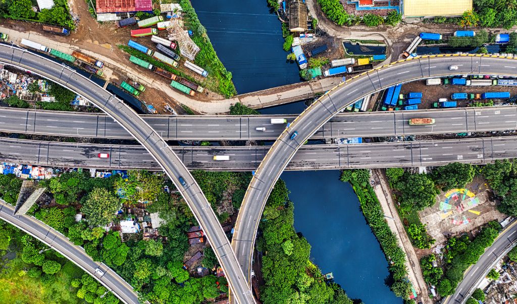
Road surveys and topographic modeling are essential for planning and managing transportation infrastructure. Conducted by drone, these surveys provide accurate data in a short time, while easily accessing difficult or dangerous areas. Aerial data collection generates detailed and up-to-date 3D models, offering improved terrain visualization and facilitating decision-making for the maintenance, design, and expansion of road networks.
Refer to our guide to help you choose the right drone to carry you Connectiv.