Precision and control for more efficient projects.
The construction industry operates in an environment where every centimeter counts, every deadline impacts costs, and every decision relies on reliable data. Roads, buildings, energy corridors, industrial facilities, and urban projects all require a detailed understanding of the terrain and volumes to mitigate risks, optimize design, and control costs.
Balko, with its modular drone-based solution, enables the collection of precise and consistent 3D geospatial data, transforming traditional surveying methods often hampered by accessibility issues, time constraints, or risks to field teams. The modular Connectiv system integrates laser scanners, inertial navigation units (INS), and specialized cameras into a single compact platform, providing comprehensive and efficient data collection during a single flight.
CONNECTIV APPLICATIONS IN THE CONSTRUCTION INDUSTRY
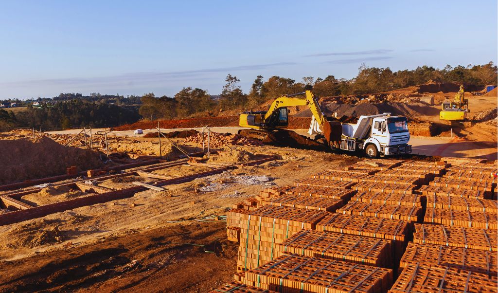
Volumetric monitoring of materials and earthworks
3D geospatial data enables the precise measurement of earth volumes excavated, stockpiled, or moved on the construction site. These measurements allow for comparison of completed work with design plans, preventing calculation errors, reducing cost overruns, and optimizing material usage. Continuous volumetric monitoring facilitates planning of subsequent phases and cost control.
Frequently used with: miniVux-1/3
High accuracy and sufficient point density for reliably calculating material and excavated volumes. Mounted on a drone, it allows for frequent and rapid site surveys, facilitating progress monitoring and volume comparisons over time, without interrupting operations.
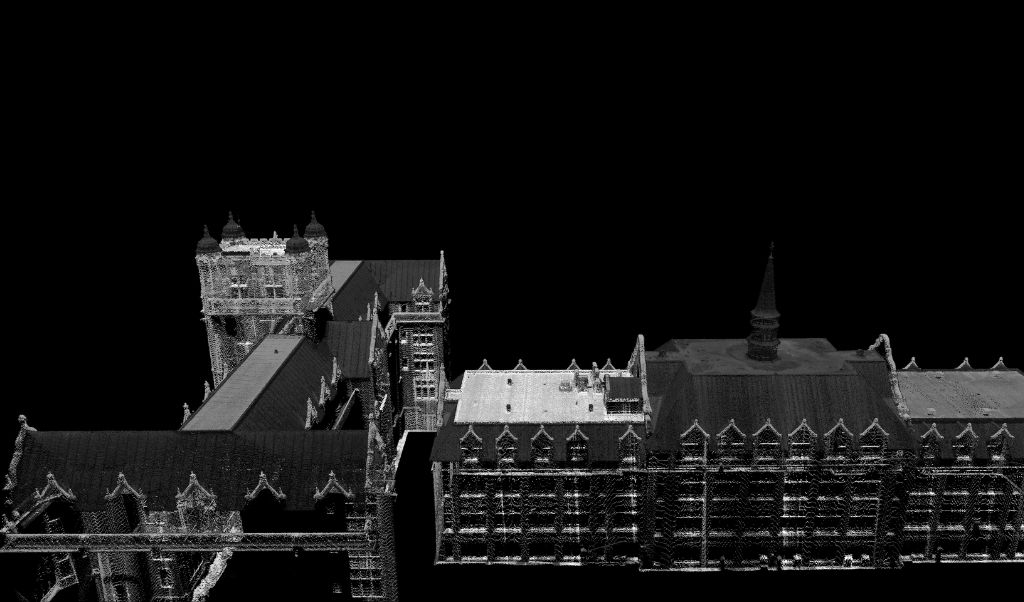
Structural conformity control
Thanks to its very high precision and ability to capture fine details, the VUX-120 is ideal for verifying geometries, alignments, and deviations from plans. Drone surveys allow for the safe inspection of complex or hard-to-reach structures.
Frequently used with: VUX-120
Very high precision and ability to capture fine details. Ideal for checking geometries, alignments and deviations from plans.
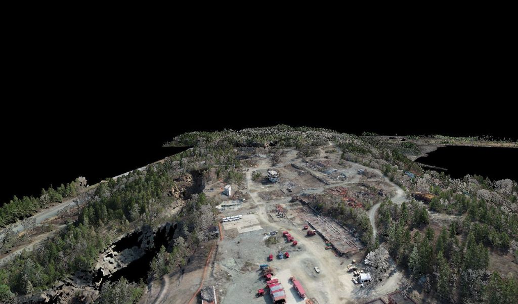
Site monitoring and security
Drones equipped with geospatial sensors provide secure monitoring of construction sites, collecting data from the air and preventing teams from being exposed to dangerous or difficult-to-access areas. They make it possible to detect unstable slopes, hazardous traffic areas, and anticipate dangers related to machinery and equipment on site, while optimizing travel logistics.
Frequently used with: XT32/M2X
A good balance between coverage, point density, and handling of mixed environments. When used on a drone, it allows for the rapid monitoring of large construction areas, the detection of changes, and the identification of potential risks.
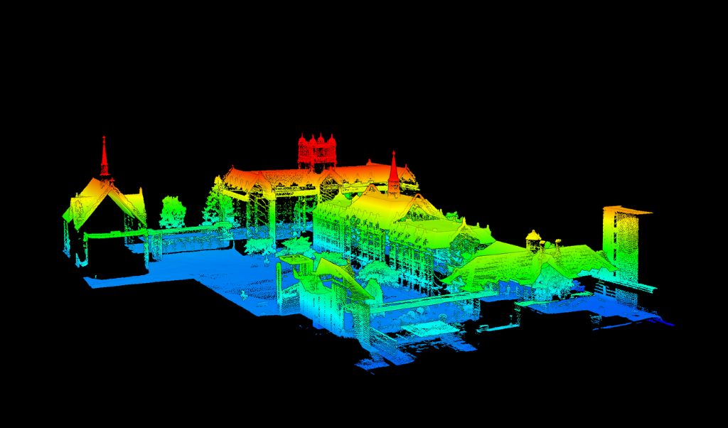
As-built documentation and BIM/GIS integration
At the end of construction, geospatial data is used to create accurate as-built documentation, integrating the final state of the structure into a digital model that can be used for maintenance, operation, or future renovations. These deliverables enrich BIM models and GIS systems, ensuring a reliable foundation for the entire infrastructure lifecycle.
Frequently used with: VUX-120
Rich and precise point clouds, perfectly suited to BIM and GIS workflows. Drone surveys ensure a complete and consistent capture of the construction site.
Do you have a project and want to know how Connectiv can make it happen? Contact us today to learn more about other applications in the construction industry.
CONFIGURE CONNECTIV FOR YOUR PROJECTS IN THE CONSTRUCTION INDUSTRY
Choose a suitable LiDAR module.
| Riegl VUX-120 | Riegl miniVUX-3 | Riegl miniVUX-1 | Hesai XT32M2X | Hesai XT32 | |
| Detection Range | 720m (@20% reflectivity) | 320m (@60% reflectivity) | 250m (@60% reflectivity) | 120m (@80% reflectivity) | 120m (@10% reflectivity) |
| Points density | Très haute (Jusqu’à 2.4M pts/sec) | Haute (300k pts/sec) | Moyenne (100k pts/sec) | Haute (640k pts/sec) | Haute (640k pts/sec) |
| Precision | 5 mm | 1 cm | 1 cm | 3 cm | 3 cm |
| Accuracy | 10 mm | 2 cm (apx 20) 4 cm (apx 15) | 2 cm (apx 20) 4 cm (apx 15) | 3 cm | 5 cm |
| Echos (returns) | Jusqu’à 32 | Jusqu’à 5 | Jusqu’à 5 | Jusqu’à 3 | Jusqu’à 2 |
| Field of view (FOV) | 100° (10° avant, nadir, 10° arrière) | 360° horizontal | 360° horizontal | 40.3° x 360° | 31° x 360° |
| Weight | ~2.5 kg | ~2.4 kg | ~2.4 kg | ~1.3 kg | ~1.7 kg |
| Key points | Très haute précision, densité maximale, détails fins. | Densité de points élevée. Idéal pour les numérisations détaillées. | Cartographie de zones restreintes. Relevés à basse altitude. | Plus léger. Efficace pour la numérisation fréquente de grandes surfaces. | Plus léger. Efficace pour la numérisation fréquente de grandes surfaces. |
| Best use case | Inspection de surfaces verticales. Contrôle et documentation de conformité structurelle, calculs de volumes complexes | Suivi volumétrique des matériaux et terrassements. | Suivi volumétrique des matériaux et terrassements. | Cartographie générale de chantier, préparation de site, suivi global | Cartographie générale de chantier, préparation de site, suivi global |
Choose the Right Camera
RGB Camera
In the construction sector, photogrammetry allows for the precise documentation of site progress and the apparent condition of structures. Photogrammetry is particularly relevant for producing orthophotos of construction sites, visually inspecting facades, and creating visual as-built deliverables. Combined with LiDAR, it complements metric data with realistic information, enhancing the integration of surveys into BIM and GIS workflows.
Multispectral Camera.
The use of a multispectral camera in construction goes beyond simply visualizing the site by revealing information invisible to the naked eye. It facilitates the early detection of problems such as moisture, material defects, or thermal stress, while also improving the monitoring of residual vegetation and the site’s environmental management. Integrated with drone surveys, it offers rapid, safe, and repeatable analysis for better decision-making throughout the project.
Monitoring construction projects using drones.
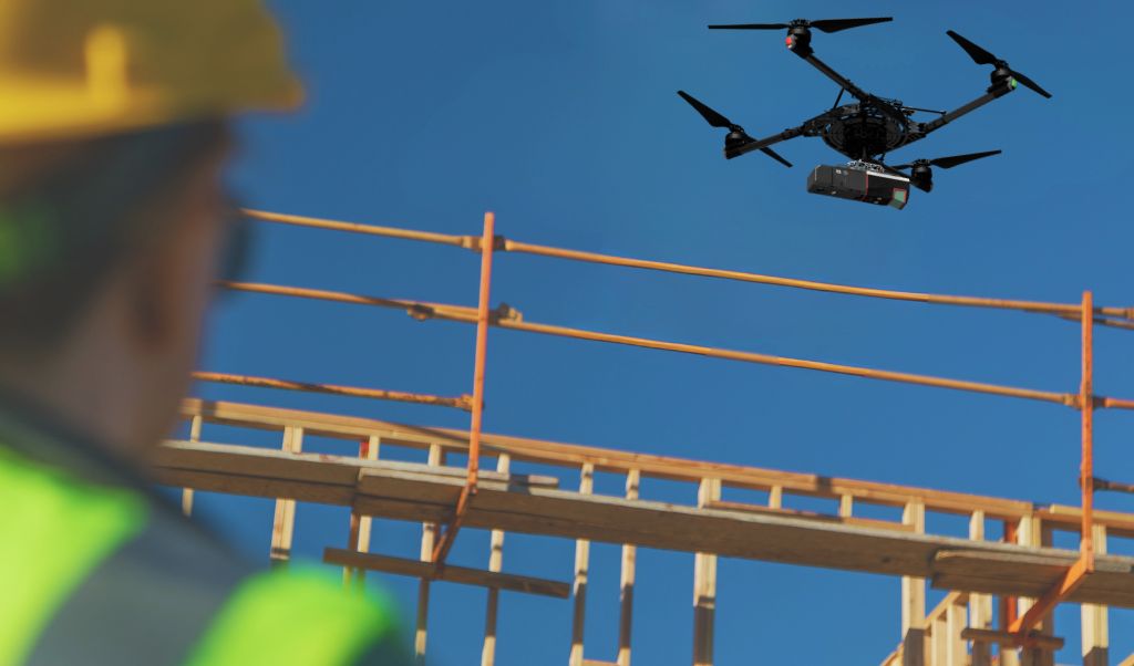
Drone-mounted geospatial sensors enable the rapid collection of high-resolution 3D data in the form of dense and consistent point clouds. This data accurately represents the natural terrain, existing structures, and works under development, even in hard-to-reach areas. This aerial approach provides a reliable foundation from the earliest stages of a project, facilitating planning, volumetric studies, and integrated design within BIM environments.
During the construction phase, drone surveys can be repeated at regular intervals to monitor the progress of the site with a high level of accuracy. This continuous data stream facilitates quality control, deviation detection, and progress tracking, while reducing rework. The collected information becomes a key tool for managing earthwork volumes, comparing the actual state to the initial plans, and documenting the entire project through to final delivery.
Consultez notre guide pour vous aider à choisir le drone adapté à votre projet, capable de porter votre Connectiv.