LiDAR and drone-mounted photogrammetry: visibility and infrastructure control
The oil and gas industry relies on extensive linear and industrial infrastructure, where every anomaly can become an operational, environmental, or regulatory risk. Pipelines, pumping stations, production platforms, access networks, and storage areas require precise knowledge of their condition and environment to plan maintenance, mitigate risks, and ensure business continuity.
Balko’s modular drone-based geospatial sensor solution offers dense, precise, and consistent three-dimensional data collection, transforming lengthy, complex, or risky inspections into reliable, repeatable operations that comply with the continuous monitoring standards specific to the oil and gas industry. The Connectiv system combines LiDAR, inertial navigation units (INS), and specialized cameras in a single compact system, enabling the simultaneous capture of all necessary information during a single flight for maximum time savings and efficiency.
CONNECTIV APPLICATIONS IN THE OIL & GAS INDUSTRY
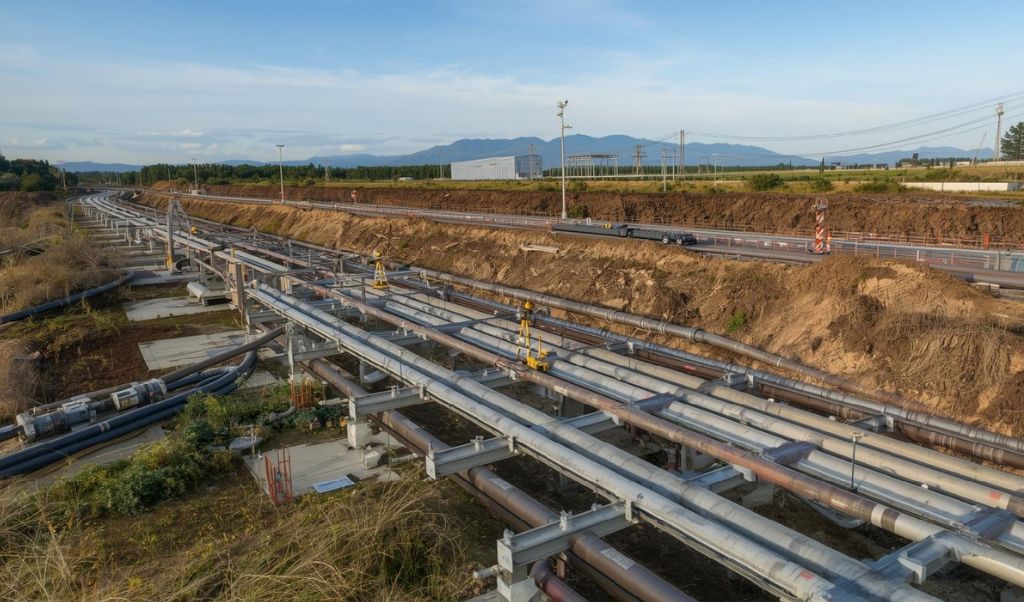
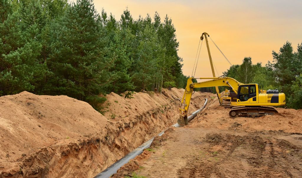
Monitoring and analysis of linear corridors
Regular surveys of pipelines, conduits, and access networks enable the detection of ground movements, subsidence, erosion, or changes in use, providing a reliable basis for prioritizing interventions and optimizing work planning. This geospatial data ensures a continuous and detailed view of the infrastructure, essential for anticipating risks and maintaining operational continuity.
Frequently used with: VUX-120
Precise level of detail, detecting the most subtle movements or changes in the infrastructure.
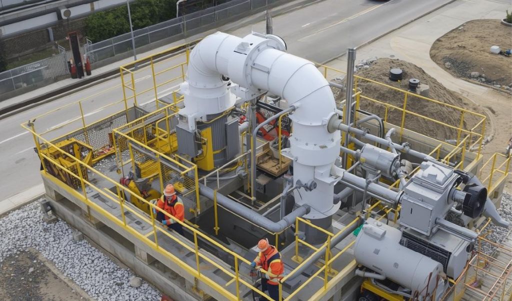
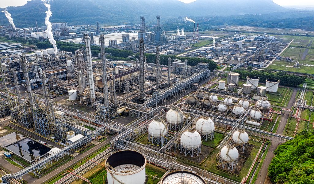
Pumping stations and industrial facilities
Drone inspections of pumping stations, platforms, and industrial sites provide a precise 3D representation of the geometry of the facilities. This data facilitates the detection of structural anomalies, the validation of clearances, and the optimization of available space for expansion or renovation projects. It also helps reduce costly rework and improve coordination between engineering, operations, and maintenance teams.
Frequently used with: miniVux-1 or miniVux-3
Geometric precision for documenting dense structures, complex piping, and closely spaced equipment. Excellent rendering of volumes and clearances, essential for work planning, maintenance, and modifications to existing installations.
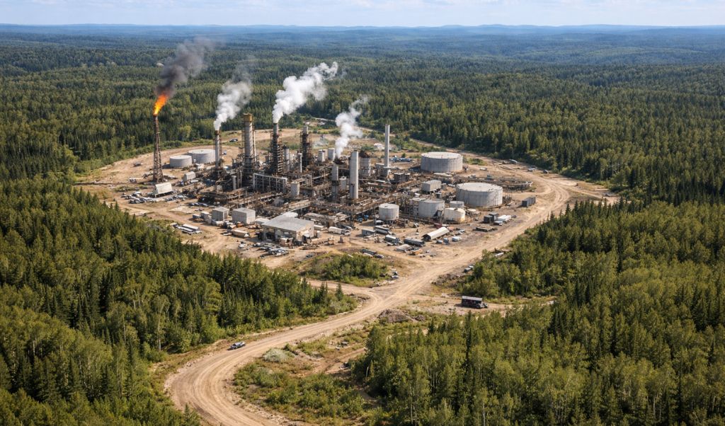
Sensitive areas and isolated sites
Drones equipped with LiDAR and cameras enable secure access and precise monitoring of high-risk areas, whether they are corrosive sites, unstable terrain, areas with high traffic of heavy equipment, or remote facilities. LiDAR captures detailed 3D measurements, even in challenging conditions or under vegetation cover, while photogrammetry provides high-resolution images to visualize the actual condition of infrastructure. Together, these technologies allow for the collection of all necessary data without exposing personnel, ensuring safety, business continuity, and improved decision-making.
Frequently used with: miniVux-1 or miniVux-3
Accuracy and 360° scanning offer good performance, both for infrastructure assessments and environmental mapping.
Logistics corridors and supply
A drone payload enables the precise mapping of access routes to industrial sites and pipelines. LiDAR generates detailed 3D models of the terrain and infrastructure, facilitating obstacle detection and optimal planning of logistics flows, while photogrammetry provides high-resolution images to visualize the condition of roads and surrounding areas. Together, these technologies help secure supplies, assess environmental impact, and effectively manage corridors, even in remote or hard-to-reach areas.
Frequently used with: VUX-120
Enables data acquisition over long distances. Particularly suited to linear projects thanks to its wide lateral coverage and its ability to maintain a homogeneous point density over large areas.
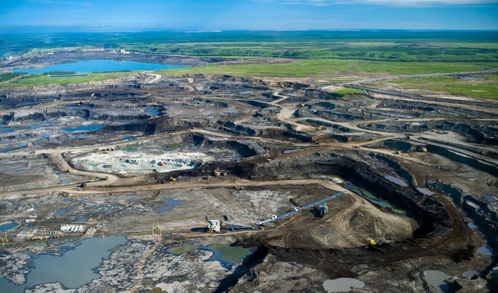
Environmental monitoring
Drones equipped with LiDAR, photogrammetry, and multispectral sensors enable precise monitoring of soils and vegetation along infrastructure. LiDAR provides detailed 3D models of the terrain and infrastructure, allowing for the detection of topographic changes and areas at risk, while photogrammetry and multispectral analysis identify anomalies in vegetation or soil at an early stage. This combined approach facilitates the anticipation of environmental risks and the planning of corrective measures before a situation becomes critical.
Frequently used with: XT32/M2X
An excellent compromise between coverage, canopy penetration and accuracy, making it a reliable tool for monitoring erosion, wetlands, regulated areas or environmental impacts around oil sites.
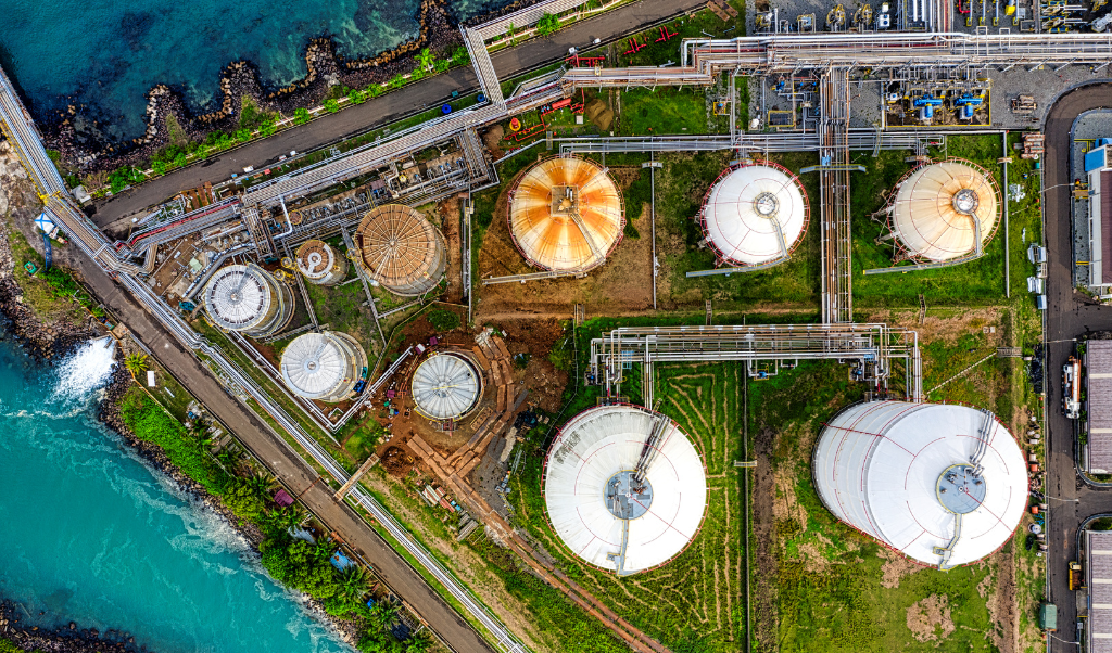
As-built documentation and asset management
Drones equipped with LiDAR and photogrammetric cameras generate precise point clouds and 3D models, enabling the creation of reliable as-built documentation after construction or interventions. This data is used to update GIS systems and BIM workflows, plan future interventions, and optimize industrial site expansions. The sensors provide detailed deliverables for linear monitoring, equipment inventory, regulatory inspections, and facility integrity tracking, offering a comprehensive and accurate view of assets.
Frequently used with: miniVux-1 or miniVux-3
Ideal precision for reliable digital twins and rigorous asset management. Optimal efficiency at medium to low altitudes.
Do you have a project and want to know how Connectiv can make it happen? Contact us today to learn more about other applications in the oil & gas industry.
CONFIGURE CONNECTIV FOR YOUR OIL & GAS INDUSTRY MANAGEMENT PROJECTS
Choose the right LiDAR module
| Riegl VUX-120 | Riegl miniVUX-3 | Riegl miniVUX-1 | Hesai XT32M2X | Hesai XT32 | |
| Detection Range | 720m (@20% reflectivity) | 290m (@60% reflectivity) | 290m (@60% reflectivity) | 120m (@10% reflectivity) | 120m (@10% reflectivity) |
| Point Density | Very High (Up to 2.4M pts/sec) | High (300k pts/sec) | Medium (100k pts/sec) | High (640k pts/sec) | High (640k pts/sec) |
| Precision | 5 mm | 1 cm | 1 cm | 3 cm | 3 cm |
| Accuracy | 10 mm | 2 cm (apx 20) 4 cm (apx 15) | 2 cm (apx 20) 4 cm (apx 15) | 3 cm | 5 cm |
| Echos (Returns) | Up to 32 | Up to 5 | Up to 5 | Up to 3 | Up to2 |
| Field of view (FOV) | 100° (10° forward, nadir, backward) | 360° horizontal | 360° horizontal | 40.3° x 360° | 31° x 360° |
| Weight | ~2.5 kg | ~2.4 kg | ~2.4 kg | ~1.3 kg | ~1.7 kg |
| Key points | Wide field of view, high dot density, high maximum range. | High precision and point density ideal for detailed scans at medium altitude. | High precision, mapping of small areas, low-altitude analysis. | Good compromise between accuracy and range, wide scanning, ideal for scanning large areas. | Good compromise between accuracy and range, wide scanning, ideal for scanning large areas. |
| Best use cases | Corridor surveys and linear site inspections. | Asset inspection, digital twins. | Low altitude. Detailed inspection of assets. | Extended coverage ideal for large areas and environmental monitoring. | Extended coverage ideal for large areas and environmental monitoring. |
Choose the Right Camera
RGB Camera
Balko’s high-resolution RGB cameras enable colorization of point clouds and the production of detailed orthophotos. They are used to document facilities, access routes, and critical equipment for the oil and gas industry.
Depending on the level of detail required:
- 24MP module offers a quick view and wide coverage;
- 61MP module is suitable for routine inspections;
- 128 MP module enables ultra-precise analysis in sensitive areas.
Use cases include monitoring pipeline condition, verifying pump station configurations, and comparing existing installations with design plans to identify any discrepancies or non-conformities. These images also aid in planning expansions or renovations by reducing errors and costly rework.
Multispectral Camera
Multispectral cameras capture up to ten spectral bands ranging from visible to near-infrared, providing in-depth environmental analysis. They enable monitoring of soil, vegetation, and material conditions around infrastructure and the early detection of environmental anomalies or risks of degradation along pipelines. Use cases include monitoring linear corridors, assessing the environmental impact of industrial facilities, and tracking vegetation to prevent encroachment or potential hazards. These multispectral images complement 3D point clouds, providing essential information for analysis and proactive planning.
Oil & gas industry management by drone
Drone surveys cover vast energy infrastructures much faster than traditional inspections. This rapid data acquisition reduces operational time, accelerates decision-making, and allows maintenance teams to intervene proactively. Teams thus have access to accurate and comparable data over time, enhancing the reliability of diagnoses and the ability to anticipate risks before they become critical.
Refer to our guide to help you choose the right drone to carry you Connectiv.