Geospatial sensor for the environment: analysis, monitoring and management of natural environments
Environmental management relies on a detailed understanding of territories to comprehend the evolution of natural environments, assess the risks associated with climate change, and plan ecological restoration. Wetlands, rivers, coastlines, forest environments, ecological corridors, and protected areas require precise and comparable three-dimensional data over time to guide scientific and operational decisions.
Balko offers an innovative approach to observing natural environments with its modular drone solution, providing precise geospatial data collection. This technology enables detailed analysis of ecological dynamics and territorial transformations while minimizing the impact of surveys on sensitive areas. The Connectiv platform combines laser scanners, inertial navigation units (INS), and specialized cameras in a single system, ensuring the simultaneous acquisition of 3D, visual, and multispectral data for comprehensive and efficient campaigns.
CONNECTIV APPLICATIONS FOR ENVIRONMENTAL RESEARCH
Natural hazard mapping and management
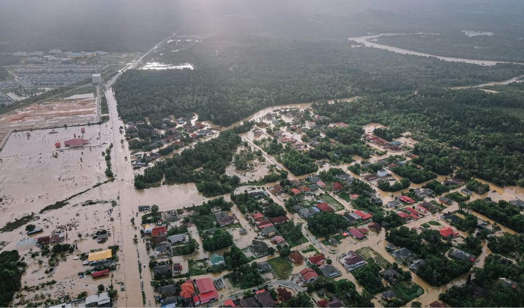
Geospatial data enables detailed modeling of topography, essential for hydrological forecasting, flood prevention, erosion control, and landslide mitigation. In wetlands and coastal areas, it facilitates the identification of micro-depressions, sediment accumulations, and breaks in ecological continuity. In mountainous environments, it supports slope stability analysis and the monitoring of at-risk areas, allowing for targeted interventions while preserving sensitive habitats.
Frequently use with: XT32/M2X
Quickly captures large areas with good accuracy and a high volume of points. Offers sufficient range to cover extensive terrain and a high measurement rate.
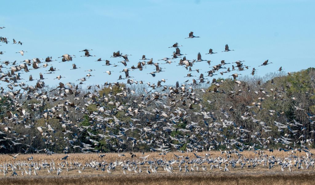
Mapping and monitoring of ecological corridors
Analysis of wildlife migration corridors, identification of fragmentation zones, and monitoring of habitat connections. This mapping allows for the planning of mitigation and restoration measures, and the protection of sensitive species in areas crossed by infrastructure or human developments.
Frequently use with: VUX-120
Detects fine details such as tree trunks, undergrowth, and horizontal and vertical landscape structures. Wide field of view with very high point density, allowing capture of corridors in all directions and identification of key habitat elements.
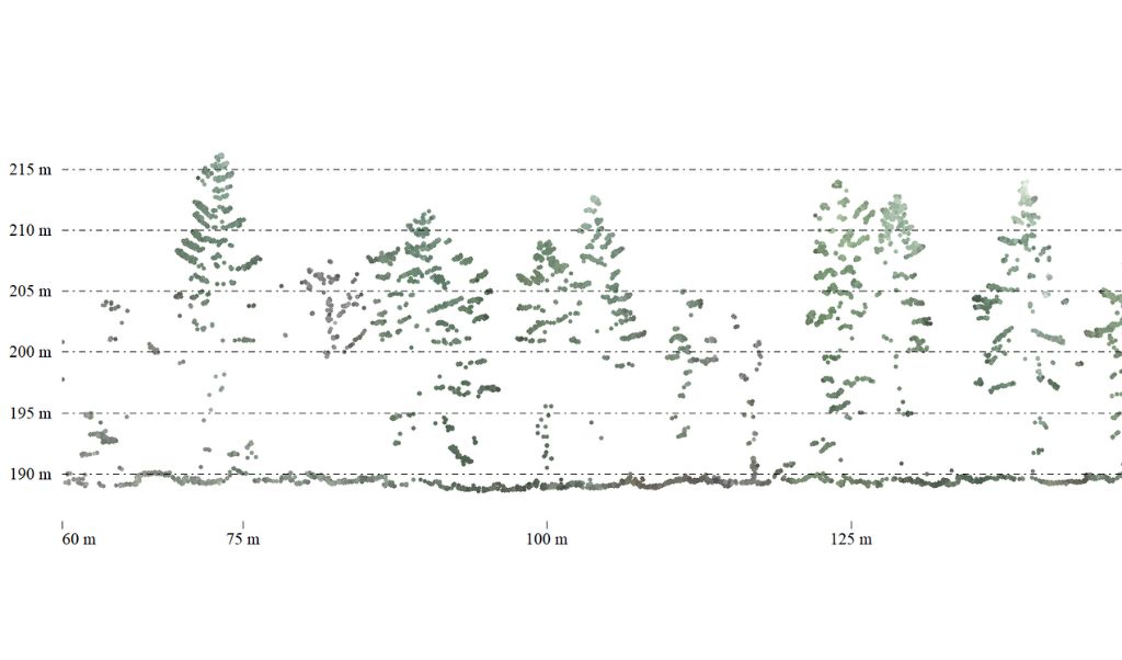
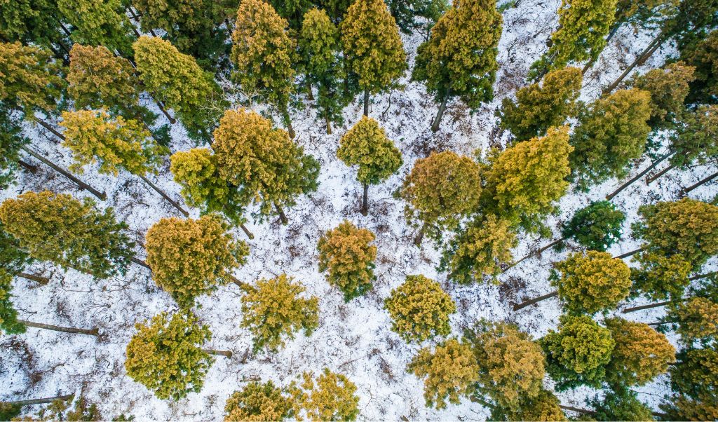
Ecological inventories and vegetation monitoring
Monitoring biomass, forest stands, and habitats allows us to assess vegetation changes following natural events or human interventions. Point clouds and multispectral imagery enable us to measure tree height, canopy density, and timber volumes, facilitating forestry planning and biodiversity management while minimizing disturbance to sensitive environments.
Frequently use with: miniVux-1/3
Ability to conduct detailed inventories by identifying species, measuring diameters, and monitoring plant growth.
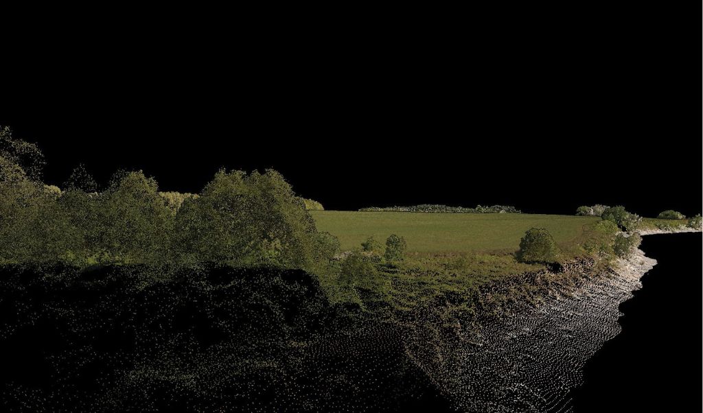
Riverbank erosion
Geospatial data provides a detailed view of hydrological and geomorphological dynamics, essential for protecting rivers, coastal areas, and watersheds. It allows for the identification of areas prone to erosion, the assessment of sediment volumes, and the monitoring of bank evolution over time. This precision supports the design of renaturalization projects, the monitoring of aquatic habitats, and flood management, offering a stable reference point for comparing successive campaigns.
Frequently use with: XT32/M2X
Ability to cover long sections of rivers or coastlines. Its wide horizontal field of view allows it to capture the entire bank in a single pass.
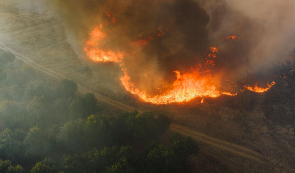
Vegetation management and fire risks
Analyzing vegetation density, moisture, and structure helps anticipate fire risks, identify critical areas, and plan forest management interventions. Multispectral data is essential for detecting drought or water stress before it impacts safety and biodiversity.
Frequently use with: VUX-120
Wide field of view and a large number of pulse returns, allowing penetration of the canopy and modeling of the different layers of vegetation and identification of areas of increased density conducive to fire starts.
Do you have a project and want to know how Connectiv can make it happen? Contact us today to learn more about other applications in environmental research.
CONFIGURE CONNECTIV FOR YOUR ENVIRONMENTAL PROJECTS
Choose the Right LiDAR Module
| Riegl VUX-120 | Riegl miniVUX-3 | Riegl miniVUX-1 | Hesai XT32M2X | Hesai XT32 | |
| Detection Range | 720m (@20% reflectivity) | 320m (@60% reflectivity) | 250m (@60% reflectivity) | 120m (@80% reflectivity) | 120m (@10% reflectivity) |
| Points Density | Very High (Up to 2.4M pts/sec) | High (300k pts/sec) | Medium (100k pts/sec) | High (640k pts/sec) | High (640k pts/sec) |
| Precision | 5 mm | 1 cm | 1 cm | 3 cm | 3 cm |
| Accuracy | 10 mm | 2 cm (apx 20) 4 cm (apx 15) | 2 cm (apx 20) 4 cm (apx 15) | 3 cm | 5 cm |
| Echos (returns) | Up to 32 | Up to 5 | Up to 5 | Up to 3 | Up to 2 |
| Field of View (FOV) | 100° (10° forward, nadir, 10° backward) | 360° horizontal | 360° horizontal | 40.3° x 360° | 31° x 360° |
| Weight | ~2.5 kg | ~2.4 kg | ~2.4 kg | ~1.3 kg | ~1.7 kg |
| Key Points | Very high density, wide field of view, long range. | High precision, high speed, fine details. | Mapping of small areas. Low-altitude surveys. | Lighter. Effective for scanning large areas. | Lighter. Effective for scanning large areas. |
| Best Use Cases | Complex mapping, dense forests, corridors | Ecological inventories, vegetation, forest fire prevention | Ecological monitoring, vegetation profiles, nearby projects. | Structural changes, mixed zones, erosion, agriculture | Structural changes, mixed zones, erosion, agriculture |
Choose the Right Camera
RGB Camera
Balko’s high-resolution RGB cameras produce detailed orthophotos and enable point cloud colorization. They facilitate the interpretation of natural structures, habitat documentation, and data integration into GIS. Use cases include vegetation monitoring, wetland mapping, forest documentation, and ecological corridor monitoring. Depending on the resolution selected, these modules allow for either rapid coverage for large-scale surveys or detailed analysis to detect subtle changes in habitats or topography.
Multispectral Camera
Multispectral cameras capture up to ten spectral bands ranging from the visible to the near-infrared. They enable the analysis of plant health, the detection of water stress, the monitoring of soil evolution, and the identification of invasive species. Use cases include vegetation mapping, monitoring of sensitive habitats, assessment of the environmental impact of infrastructure, and the monitoring of ecological restoration projects. These images complement 3D point clouds by providing essential spectral information for informed decision-making and for guiding conservation policies.
Time-based monitoring and environmental indicators using drones
Repeated campaigns ensure data comparability over time, which is essential for measuring environmental changes, identifying habitat loss, monitoring invasive species, and evaluating the effectiveness of restoration projects. Series of LiDAR and multispectral surveys thus become a powerful decision-making tool for guiding conservation policies and adapting conservation strategies based on observed results. The use of drones for environmental research provides access to vast and remote areas and allows for more frequent data collection, leading to more comprehensive research.
Refer to our guide to help you choose the right drone to carry you Connectiv.