Key Takeaways
- Balko adds the RTX option to the INS modules of the Connectiv modular system, complementing the APX-15 and APX-20 INS.
- RTX, Trimble’s satellite correction service, offers centimeter-level accuracy anywhere in the world without a base station.
- No local infrastructure or cellular connection required: corrections are delivered directly via satellite, even in remote areas.
- Ideal for BVLOS missions, remote sites and multi-site projects where data consistency is essential.
More flexibility, less setup
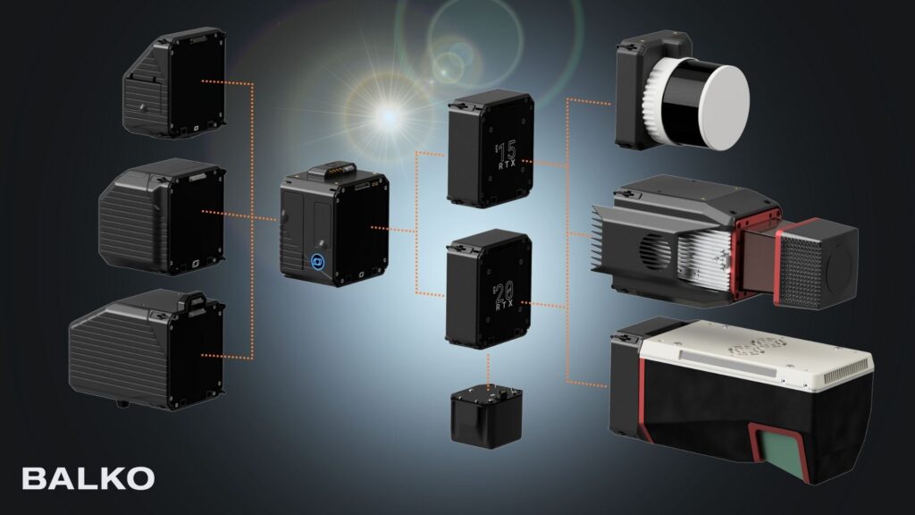
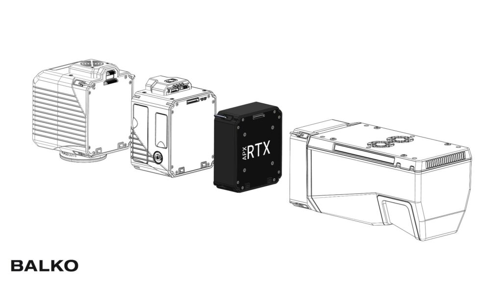
At Balko, our modular geospatial data sensor gives professionals the freedom to adapt their LiDAR, camera, and INS modules to any mission. To enhance this flexibility even further, we’re expanding our INS lineup, currently available with the APX-15 and APX-20 modules, by adding the Applanix RTX option. APX-30 and APX-50 are also added to the offering. This addition allows users to achieve centimeter-level accuracy anywhere in the world, without relying on a local GNSS base or RTK network.
What is RTX, and how does it differ from standard INS configurations?
RTX (Real-Time eXtended) is a satellite-based correction service developed by Trimble, designed to provide high-accuracy GNSS positioning globally. Unlike traditional RTK or PPK workflows that depend on a base station or network corrections, RTX uses a constellation of geostationary satellites to deliver correction data directly to the receiver.
In short:
- Standard INS (without RTX) requires local reference data to achieve centimeter accuracy.
- INS with RTX receives global corrections via satellite, offering the same precision with no local infrastructure needed.
This makes RTX particularly valuable for missions conducted in remote or dynamic environments, where setting up a base station is not practical or even possible.
The benefits of the RTX option
Adding the RTX option to your INS setup introduces multiple operational and technical advantages:
| INS without RTX (Classic RTK / PPK) | INS with RTX | |
| Source of correction | Local base stations or VRS network (NTRIP) | Global network of reference stations + satellite-delivered corrections |
| Dependence on infrastructure | Requires a nearby base station or available RTK network | No local base station required, works anywhere in the world |
| Connection required | Radio or cellular link to receive real-time corrections | No local connection needed, corrections received directly via satellite |
| Range and mobility | Limited: accuracy decreases with distance from base or network | Unlimited: centimetre-level accuracy globally, even in remote or BVLOS operations |
| Setup time | Base station installation or network verification required before each mission | Minimal: standard INS setup, immediate reception of corrections |
| Reliability in challenging environments | Sensitive to obstacles, areas with no cellular coverage, or complex terrain | Very reliable: satellite-based corrections, consistent performance even in remote environments |
| Accuracy | Centimeter-level, but dependent on distance and network quality | Consistent centimeter-level, in real-time and post-processing |
| Post-processing | Often required to correct signal loss or improve accuracy | Optional: RTX corrections available in post-processing if needed |
| Ideal for | Areas well-covered by RTK networks or local base stations | Global missions, remote sites, BVLOS operations, multi-site projects |
When RTX makes a difference
Imagine a surveying team tasked with mapping a remote mountainous area. The terrain is rugged, cellular coverage is non-existent, and the nearest base station is many kilometers away. With the RTX-enabled INS module, the team can fly their drone and capture high-accuracy LiDAR data immediately, without worrying about infrastructure or signal interruptions. What would have been a complex, time-consuming operation becomes efficient and reliable, allowing the team to focus on the mission instead of logistics.
In another scenario, an engineering firm is working on a cross-border infrastructure project. The site spans multiple regions, each with different RTK networks, and consistent data quality is critical for decision-making. By using RTX, the firm ensures centimeter-level accuracy across the entire project area, eliminating discrepancies between zones and speeding up post-processing. The team can confidently deliver precise maps and models, even across remote or inconsistent networks.
In both situations, RTX empowers professionals to fly further, map faster, and maintain accuracy, making it a game-changer for challenging missions.
An essential option!
With the addition of the RTX option to our INS modules offering, Balko continues to expand the capabilities of its modular geospatial platform.
This new level of flexibility empowers users to plan, execute, and deliver high-precision mapping missions anywhere, with minimal setup and maximum confidence.
Whether you’re flying in remote valleys, dense forests, or vast open terrain, RTX ensures your positioning stays as precise as your data.
Would you like to learn more about the RTX option?
📩 Contact our team for more details or a personalized quote.
FAQ – Key Takeaways
RTX (Real-Time eXtended) is a satellite correction service developed by Trimble. It provides high-precision GNSS positioning on a global scale via a constellation of geostationary satellites that transmit corrections directly to the receiver.
The RTX option is available across Balko’s INS module lineup, currently with the APX-15 and APX-20, and also extends to the APX-30 and APX-50. It complements the Connectiv modular system, which allows LiDAR, camera and INS modules to be adapted to each mission.
A standard INS requires local reference data (base station or RTK network) to achieve centimeter-level accuracy. An INS with RTX receives corrections via satellite and delivers the same accuracy without any local infrastructure.
RTX is particularly valuable in remote areas without cellular coverage, on BVLOS missions, or for multi-site and cross-border projects where consistent precision across zones is essential and installing a base station is impractical.
Yes. RTX provides consistent centimeter-level accuracy in real time, and corrections remain available for post-processing if needed. Post-processing, often mandatory with standard RTK/PPK workflows, becomes optional with RTX.
Other news
News
20260522
Balko and ARA Robotics Announce a Strategic Partnership
Quebec, Canada — Balko and ARA Robotics announce the signing of a strategic partnership...