Drone‑mounted LiDAR & photogrammetry: catalyzing innovation in energy
Modern energy networks rely on accurate, up-to-date spatial data. With the rise of renewable energy, expanding power grids, and increasingly stringent safety standards, reliable mapping and inspection solutions are more vital than ever. Balko delivers precise, actionable insights for the energy sector with cutting-edge LiDAR and photogrammetry systems mounted on drones.
CONNECTIV APPLICATIONS IN ENERGY AND UTILITIES
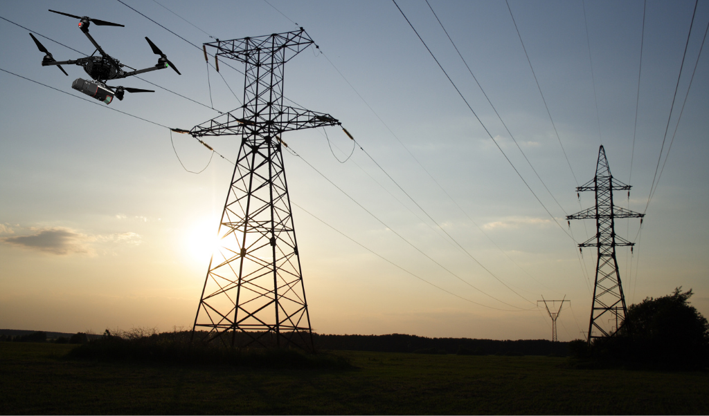
Transmission Line Analysis & Corridor Management
Preventing outages and ensuring regulatory compliance depend on maintaining clear, safe corridors for power transmission. Drone-mounted LiDAR, RGB, and multispectral cameras enable high-resolution mapping of towers, conductors, and surrounding vegetation. Satellite navigation combined with the use of a hybrid drone allows operation in the most remote and challenging environments. The result: utility teams can detect risk areas, monitor encroachment, and optimize maintenance schedules with a fraction of the costs of traditional methods.
Frequently used with: VUX-120
High point density and precision to digitize assets, and give the ability to penetrate dense canopy for precise ground modeling.
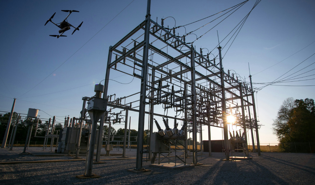
Substation and Asset Digitalization
Critical infrastructure like substations, transformers, and switchyards must be well documented and accessible for inspection. High-resolution cameras, LiDAR, and thermal imaging allow for remote and detailed inspection of critical substation components. Maintenance teams can identify potential issues, verify as-built conditions, and support rapid repairs after adverse events.
Frequently used with: miniVux-1 or miniVux-3
Compact and lightweight, high-resolution scanning- ideal for reliable detail. Combine with RGB 128 MP camera for even more detail.
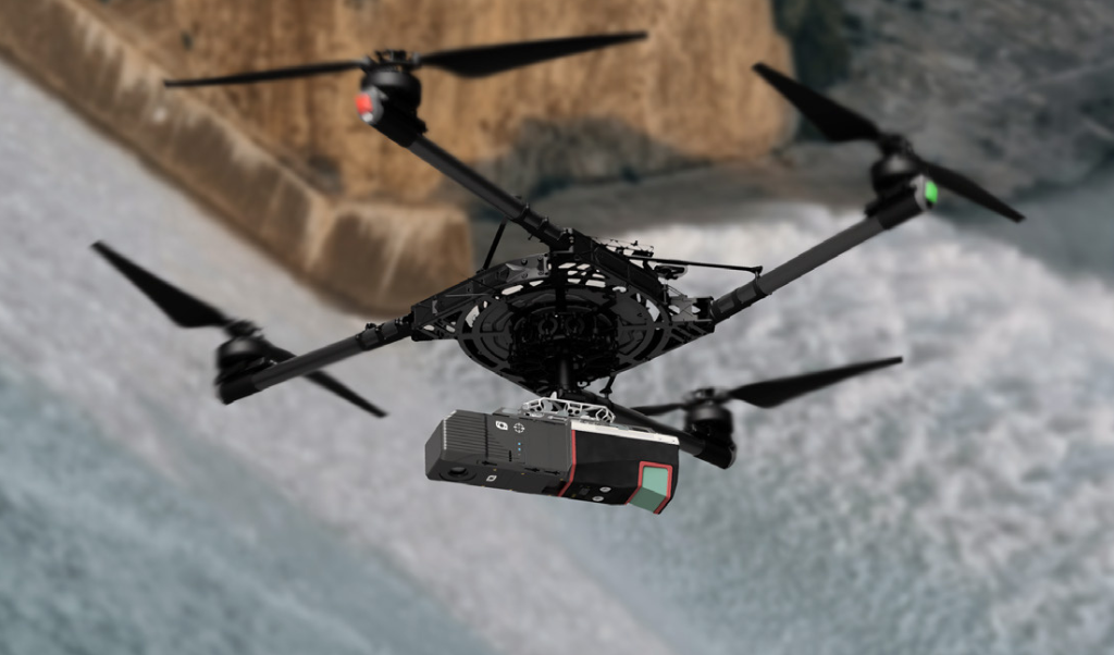
Hydroelectric Dam Monitoring & Modernization
Hydropower facilities are complex environments where infrastructure, topography, and water flow dynamics all play critical roles in safety and performance. Continuous monitoring is essential to detect early signs of wear, erosion, or leakage. Equipped with LiDAR, vertical cameras, and multispectral sensors, Connectiv ensures comprehensive and precise data acquisition to support engineering decisions. LiDAR generates high-precision 3D models of dam faces, spillways, embankments, and access roads, while photogrammetry delivers detailed orthophotos and visual documentation of the site.
Frequently used with: VUX-120
Combination of LiDAR and vertical imaging detects structural issues like cracks, spalling, and delamination.
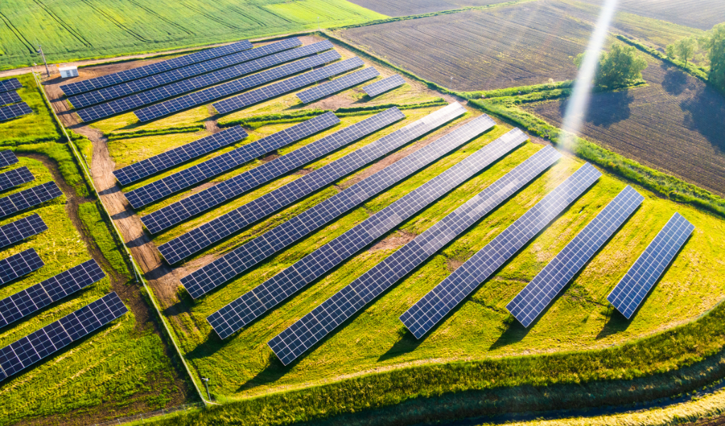
Wind and Solar Farm Optimization
The success of renewable projects hinges on site selection and ongoing inspection. LiDAR point clouds accurately model the terrain, guiding turbine placement or solar array layouts for maximum efficiency. Photogrammetry provides detailed visual records for panel inspections, structural alignment, and progress tracking, ensuring both performance and investment protection.
Frequently used with: XT32/M2X
High density and range that can cover vast landscapes.
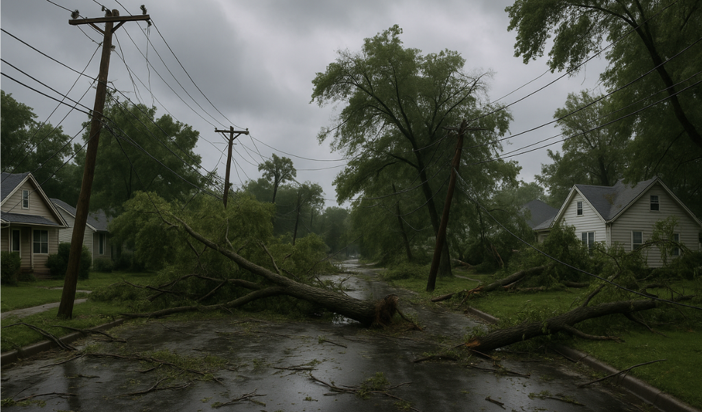
Disaster Response & Resilience Planning
Natural hazards such as storms, landslides, or floods can threaten energy assets. Using drones equipped with LiDAR and high-resolution cameras, utilities can quickly assess damage across vast areas, prioritize repairs, and update risk models. Consistent, repeatable data enables better preparation and faster recovery.
Frequently used with: VUX-120
Assess long transmission corridors, map large damaged areas, or quickly identify hazards.
You have a project and would like to know how Connectiv can achieve it? Contact us today to learn more about more applications in forestry.
CONFIGURE CONNECTIV FOR YOUR ENERGY AND UTILITIES MANAGEMENT PROJECTS
Choose the Right LiDAR Module
| Riegl VUX-120 | Riegl miniVUX-3 | Riegl miniVUX-1 | Hesai XT32M2X | Hesai XT32 | |
| Detection Range | 720m (@20% reflectivity) | 290m (@60% reflectivity) | 290m (@60% reflectivity) | 120m (@10% reflectivity) | 120m (@80% reflectivity) |
| Point Density | Very High (Up to 2.4M pts/sec) | High (300k pts/sec) | Medium (100k pts/sec) | High (640k pts/sec) | High (640k pts/sec) |
| Precision | 5 mm | 1 cm | 1 cm | 3 cm | 3 cm |
| Accuracy | 10 mm | 2 cm (apx20) 4 cm (apx15) | 2 cm (apx20) 4 cm (apx15) | 3 cm | 5 cm |
| Echos (Returns) | Up to 32 | Up to 5 | Up to 5 | Up to 3 | Up to 2 |
| Field of View (FOV) | 100° (10° forward, nadir, 10° backward) | 360° horizontal | 360° horizontal | 40.3° x 360° | 31° x 360° |
| Weight | ~2.5 kg | ~2.4 kg | ~2.4 kg | ~1.3 kg | ~1.7 kg |
| Key points | High precision and density, well suited for high altitude scans. | High point precision, ideal for detailed medium altitude scans. | High Precision Small-area mapping Low-altitude scans. | Light, high-density point cloud, ideal for wide-area scanning. | Light, high-density point cloud, ideal for wide-area scanning. |
| Best Use Cases | Corridor mapping, transmission lines, high precision. | Asset inspection, large area surveying | Low altitude. Asset inspection | Wide-area coverage. | Wide-area coverage. |
Choose the Right Camera
RGB Camera
An RGB camera provides true-color imagery that, when paired with point cloud data, produces colorized 3D models for improved visualization and interpretation of energy infrastructure. This integration supports the inspection and documentation of assets such as power lines, substations, wind turbines, solar farms, and pipelines. By adding RGB imagery to Connectiv’s LiDAR data, operators can verify the condition of critical structures, identify corrosion or damage, assess equipment alignment, and generate detailed digital twins. This makes asset management and reporting more accessible and actionable for energy and utility professionals.
Multispectral Camera
Multispectral cameras capture data across several spectral bands, including those not visible to the human eye, such as near-infrared. This capability enables early detection of equipment overheating, insulation deterioration, or potential leaks, often before issues become visible through standard inspection methods. Multispectral imaging also enhances the ability to monitor vegetation health around transmission corridors or substations, supporting preventative maintenance to reduce outage risks. Combined with Connectiv’s LiDAR solutions, multispectral data offers deeper insights into asset integrity and environmental conditions, enabling more precise and proactive decision-making for energy and utility operations.
Energy and Utilities Management by Drone
Using drones for energy and utilities management has revolutionized asset inspection, maintenance, and monitoring. However, selecting the right drone for the task is essential to ensure safety, efficiency, and high-quality data collection. The right drone platform will have the necessary payload capacity, flight endurance, and stability to carry advanced sensors like LiDAR, RGB, or multispectral cameras across wide areas and challenging environments.
For example, long-endurance drones are better suited for surveying extensive transmission corridors, while agile multirotor drones excel at close-up inspections of substations or wind turbines. Choosing the appropriate drone also ensures compliance with local regulations and safe operation near critical infrastructure. Ultimately, matching the drone’s capabilities to the project requirements enables energy and utility operators to obtain accurate, actionable data while minimizing operational risks and downtime.
Refer to our guide to help you choose the right drone to carry you Connectiv.