Effective, even over dense canopy
Balko’s modular LiDAR and imagery solutions provide a high-precision, adaptable tool for modern forest management. Designed to penetrate dense canopies and generate accurate 3D data, our technology enables forestry professionals to monitor tree health, assess biomass, plan sustainable harvesting, and mitigate environmental risks. With the flexibility to swap sensors for different project needs, Balko’s LiDAR and phtogrammetry systems help optimize forest operations while ensuring long-term sustainability.
CONNECTIV APPLICATIONS IN FORESTERY MANAGEMENT
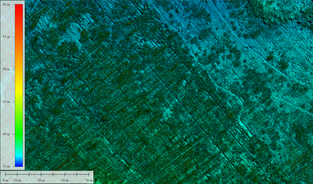
Digital Terrain Modeling (DTM)
LiDAR-equipped drones can penetrate dense forest canopies to capture detailed ground measurements. This capability allows for the creation of accurate digital terrain models, essential for understanding topography, slope, and drainage patterns, which influence forest health and planning.
Frequently used with: VUX-120
High point density and ability to penetrate dense canopy for precise ground modeling.
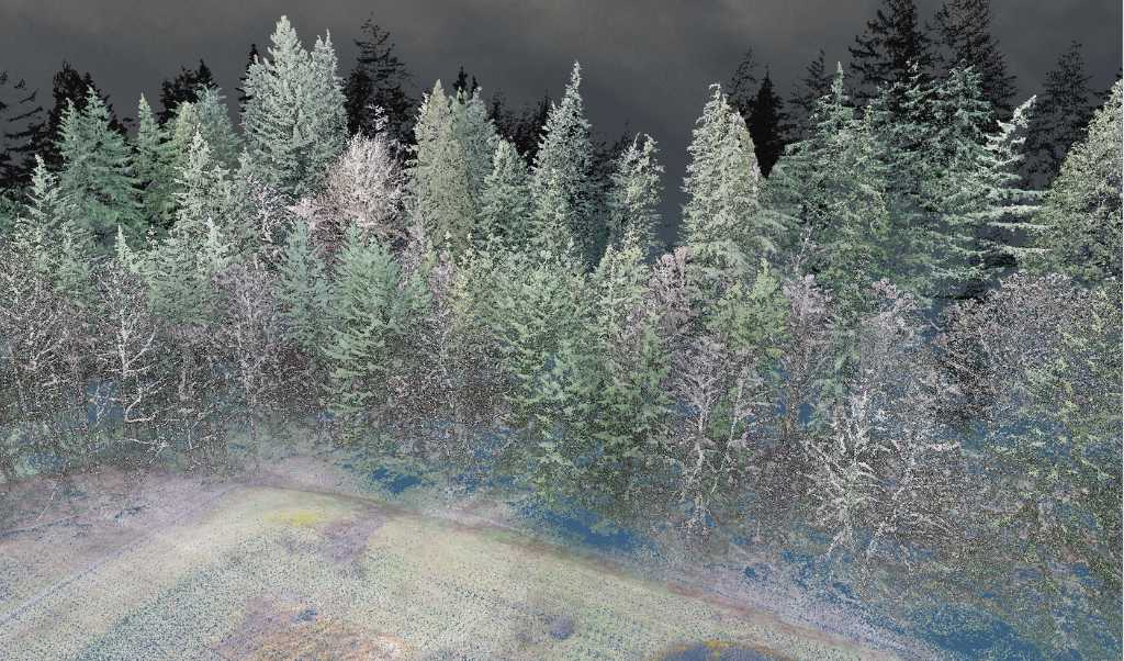
Forest Biomass Assessment and Inventory
High-resolution LiDAR data enables precise measurements of tree attributes, including height, trunk diameter, and crown dimensions. These metrics are crucial for calculating standing timber volume and estimating biomass, aiding in sustainable forest resource management.
Frequently use with: miniVux-3
Compact, lightweight, and high-resolution scanning ideal for tree height, trunk diameter, and biomass assessment.
Species Identification and Health Assessment
When combined with high-resolution RGB or multispectral cameras, LiDAR systems facilitate species identification and health monitoring. This integration allows for comprehensive assessments of forest composition and vitality, supporting biodiversity conservation efforts.
Frequently use with: XT32M2X and XT32
Combination of LiDAR and optical imaging provides detailed species and health data.
Environmental Monitoring of Forest and Impact Analysis
LiDAR data is instrumental in evaluating the effects of logging and other activities on forest ecosystems. By quantifying changes in land cover and forest structure, stakeholders can develop strategies to mitigate adverse impacts and promote sustainable practices.
Frequently use with: VUX-120
High accuracy and range for assessing changes in land cover and forest structure.
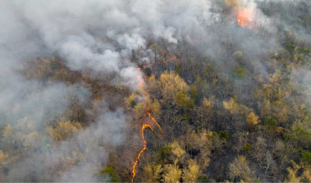
Wildfire Prevention and Management
Detailed terrain and vegetation data from LiDAR surveys assist in identifying areas susceptible to wildfires. This information is vital for creating firebreaks, planning controlled burns, and implementing other preventive measures to reduce wildfire risks.
Frequently use with: miniVux-3
Effective for mapping fuel loads and canopy density to predict fire risks.
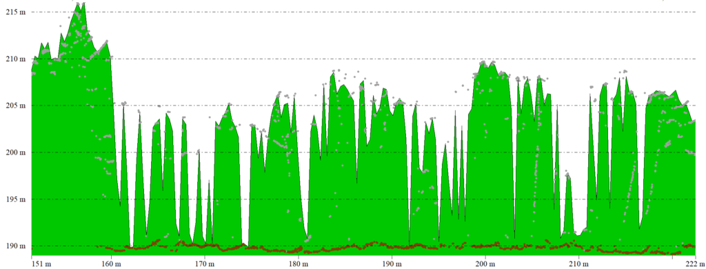
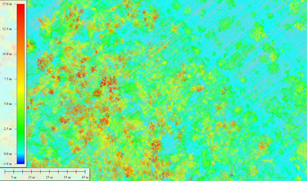
Canopy Structure Analysis
LiDAR technology provides insights into the vertical complexity of forest canopies, offering valuable information on habitat quality and biodiversity. Understanding canopy structure is essential for wildlife management and conservation planning.
Frequently use with: miniVux-1 or miniVux-3
Offers high-resolution vertical profiling of forest canopy layers.
Carbon Sequestration Studies
Accurate LiDAR measurements of tree dimensions and forest density enable the estimation of carbon stocks. This data supports efforts to monitor carbon sequestration, contributing to climate change mitigation strategies.
Frequently use with: Vux-120
High precision and penetration through canopy for accurate carbon stock calculations.
You have a project and would like to know how Connectiv can achieve it? Contact us today to learn more about more applications in forestry.
CONFIGURE CONNECTIV FOR YOUR FORESTRY MANAGEMENT PROJECTS
Choose the right LiDAR Module
| Riegl VUX-120 | Riegl miniVUX-3 | Riegl miniVUX-1 | Hesai XT32M2X | Hesai XT32 | |
| Detection Range | 720m (@20% reflectivity) | 320m (@60% reflectivity) | 250m (@60% reflectivity) | 120m (@80% reflectivity) | 120m (@10% reflectivity) |
| Point Density | Very High (Up to 2.4M pts/sec) | High (300k pts/sec) | Medium (100k pts/sec) | High (640k pts/sec) | High (640k pts/sec) |
| Precision | 5 mm | 1 cm | 1 cm | 3cm | 3cm |
| Accuracy | 10 mm | 2cm (apx20) 4 cm (apx15) | 2cm (apx20) 4 cm (apx15) | 3cm | 5 cm |
| Echos (Returns) | Up to 32 | Up to 5 | Up to 5 | Up to 3 | Up to 2 |
| Field of View (FOV) | 100° (10° forward, nadir, 10° backward) | 360° horizontal | 360° horizontal | 40.3° x 360° | 31° x 360° |
| Weight | ~2.5 kg | ~2.4 kg | ~2.4 kg | ~1.3 kg | ~1.7 kg |
| Key points | High precision. Large-area mapping. | High point density. Ideal for detailed scans. | Lightweight, suited for small drones. Small-area mapping. Low-altitude surveys. | Lighter. Efficient for wide-area scanning. | Lighter. Efficient for wide-area scanning. |
| Best Use Cases | Terrain modeling. Carbon sequestration. Environmental monitoring. | Biomass estimation. Wildfire risk assessment. | Tree inventory. Canopy analysis. | Biomass estimation. Detection of forest species. | Biomass estimation. Detection of forest species. |
Choose the Right Camera
RGB Camera
RGB camera adds true-color imagery to point cloud data, creating colorized 3D models that improve visualization and interpretation. This allows for tree species identification, forest health monitoring, and terrain mapping with greater accuracy. When combined with Connectiv’s LiDAR data, RGB imagery helps verify vegetation classification, detect deforestation patterns, and improve digital twin models of forested areas, making reports more accessible and actionable for forestry professionals.
Multispectral Camera
Multispectral cameras capture light in multiple spectral bands, such as near-infrared (NIR), which is invisible to the human eye. This enables early detection of tree stress, disease, and pest infestations before visible symptoms appear. It also helps classify vegetation types, monitor tree vitality, and assess forest biodiversity. When combined with Connectiv’s LiDAR data, multispectral imaging provides deeper insights into forest health, allowing for more precise management decisions in conservation, logging, and reforestation efforts.
Forest Mapping by Drone
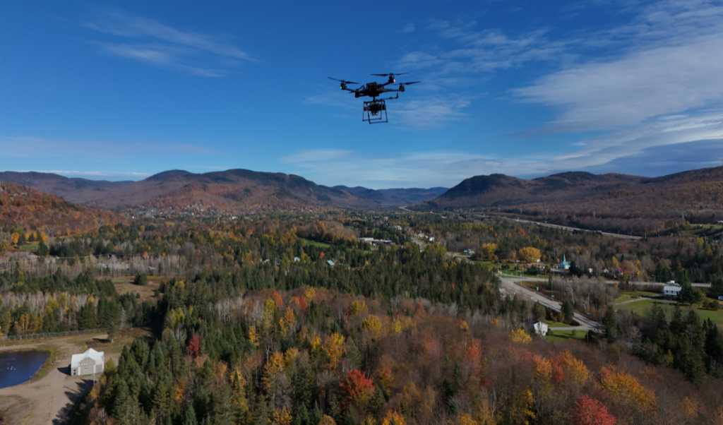
Choosing the right drone for your forestry projects is crucial for ensuring accurate data collection and operational efficiency. The type of drone impacts the quality of your LiDAR measurements, flight duration, and the ability to navigate dense forest canopies. Selecting a drone that matches your project needs, such as payload capacity, flight range, and sensor compatibility, will optimize your workflow and ensure you gather the most precise data for forest inventory, health assessments, and terrain modeling. The right drone also enables you to meet regulatory requirements and operate in challenging environments, enhancing the overall success of your forestry management efforts.
Refer to our guide to help you choose the right drone to carry you Connectiv.