A single platform to capture and process your geospatial data.
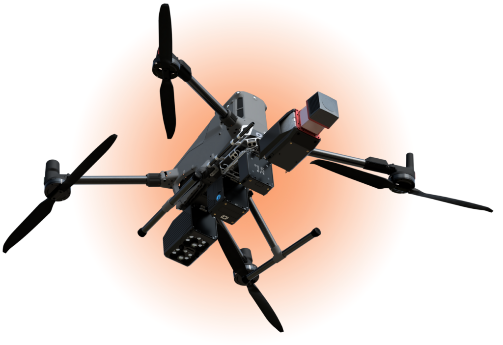
Balko designs a modular geospatial sensor and develop its integrated software to simplify the acquisition and processing of high-precision data in a multitude of projects. Connect together different LiDAR, cameras and IMU modules for a personnalized and reconfigurable tool that match your missions.
More work done, less equipment
Configure Connectiv System
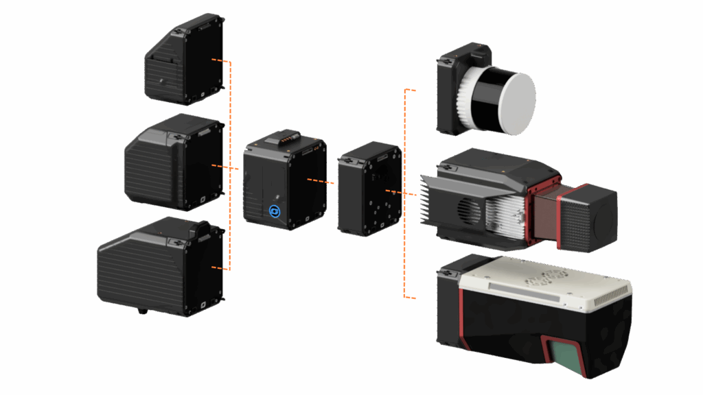
Connect your selected camera, INS and LiDAR modules on the computer core to achieve your project’s goals.
Capture Data with your Drone
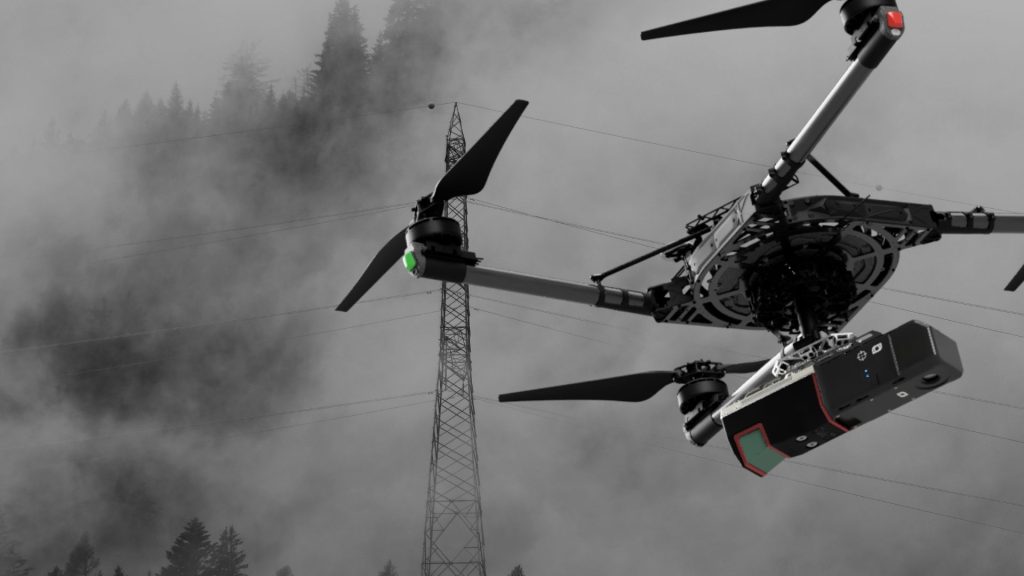
Connectiv can be fixed on almost any drone that can support its weight. Use it for mapping, inspection, monitoring and more.
Process Data in e-LAS
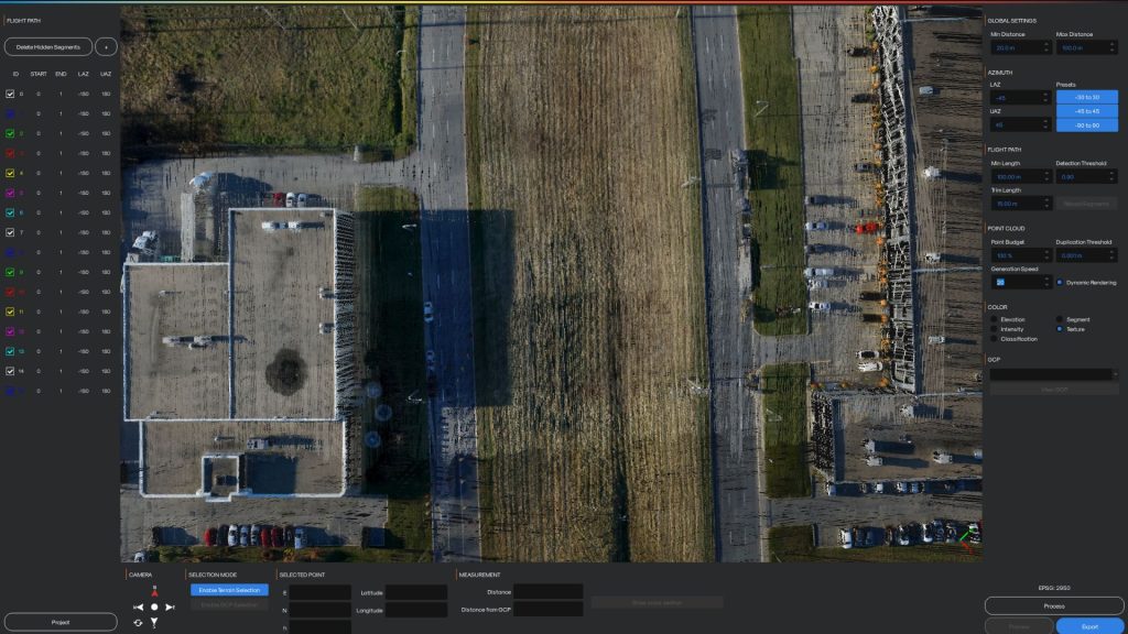
Get a calibrated, aligned, adjusted, colourized and georeferenced point cloud (LAS) in minutes. Get the best precision and accuracy possible.
Designed for all industries
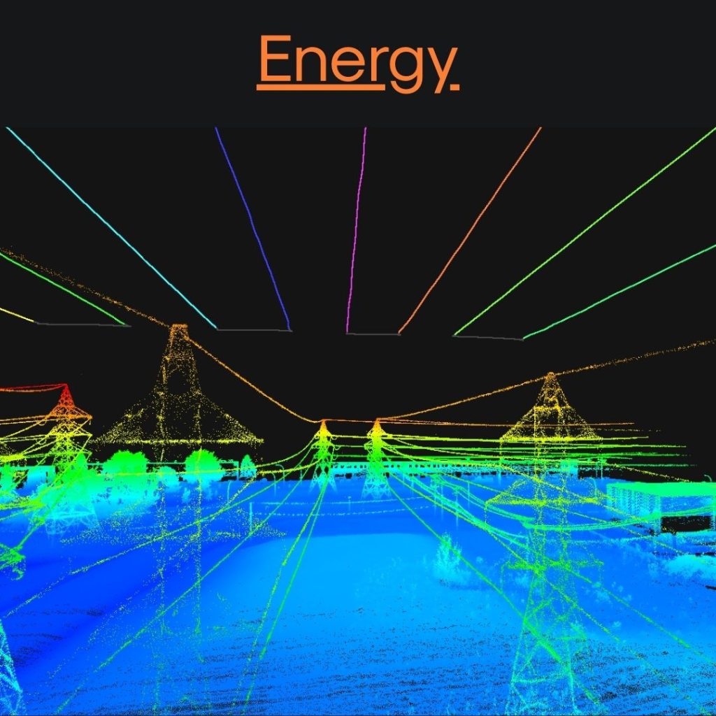
Inspect. Map. Maintain.
Acquire precise corridor and asset data efficiently. Create high-resolution maps that support inspection, maintenance planning, and long-term infrastructure management.
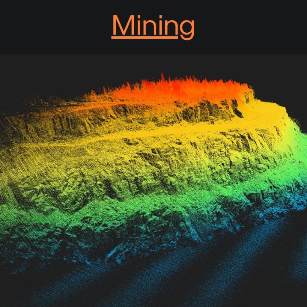
Survey. Monitor. Optimize.
Capture reliable site data in complex environments. Generate accurate 3D maps to track volumes, slopes, and infrastructure while reducing on-site risk and improving operational decisions.
Plan. Assess. Maintain.
Turn corridor and site data into actionable insights. Build accurate maps that support route planning, condition assessment, and infrastructure maintenance from early studies to ongoing operations.
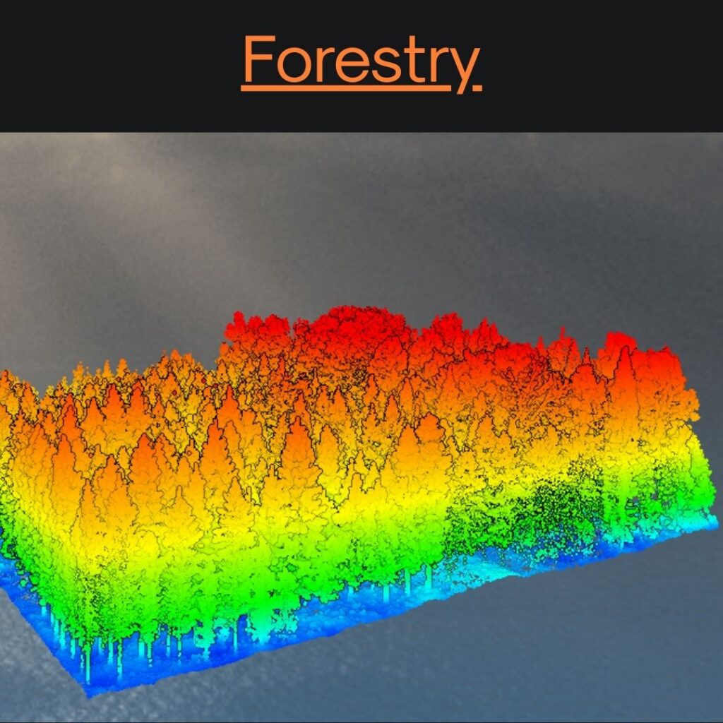
Analyze. Measure. Manage.
Map large forested areas with consistency and precision. Produce reliable datasets to assess terrain, vegetation structure, and change over time for sustainable resource management.
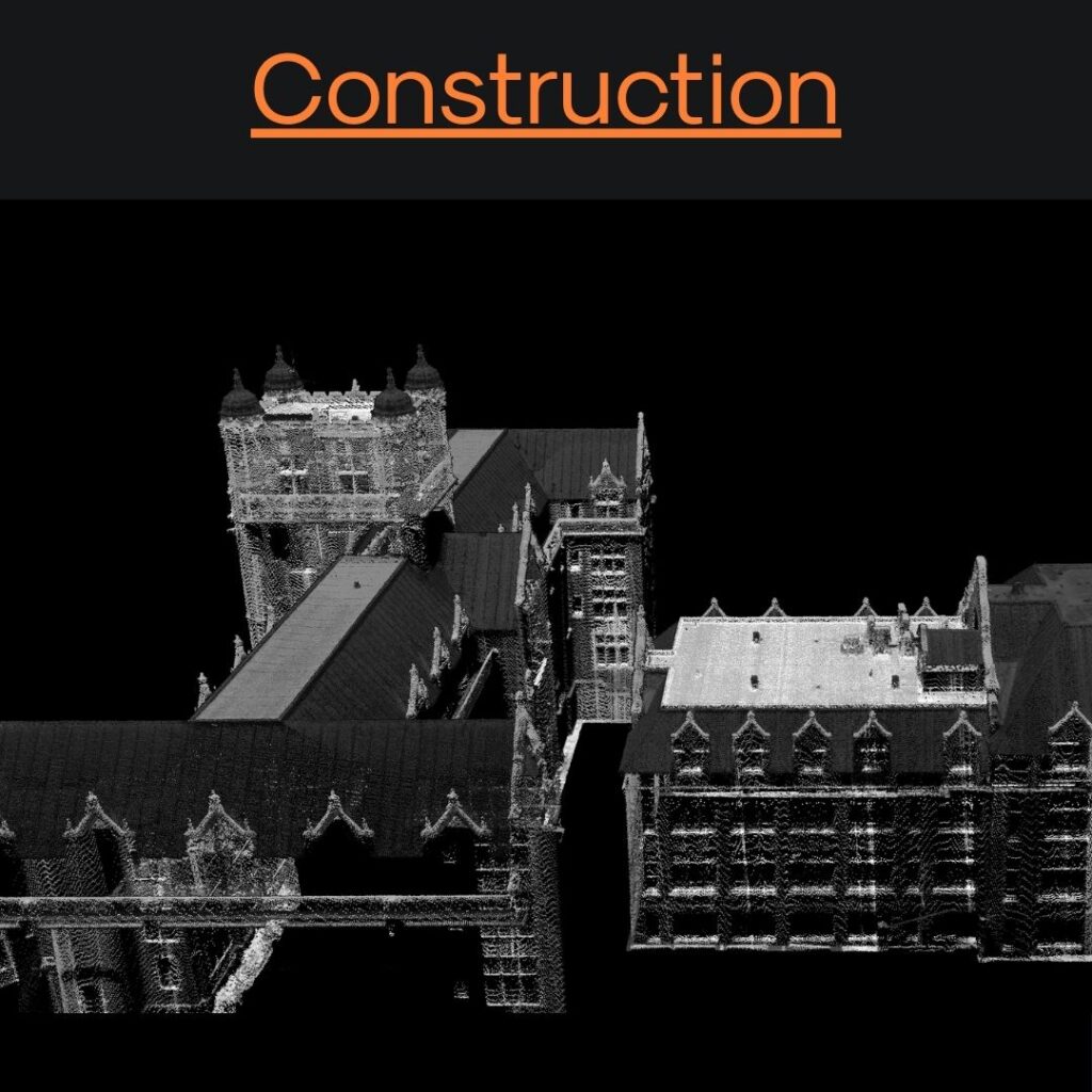
Plan. Build. Validate.
Transform site data into visual, actionable information. Create accurate maps that support planning, progress tracking, and as-built documentation from mobilization to closeout.
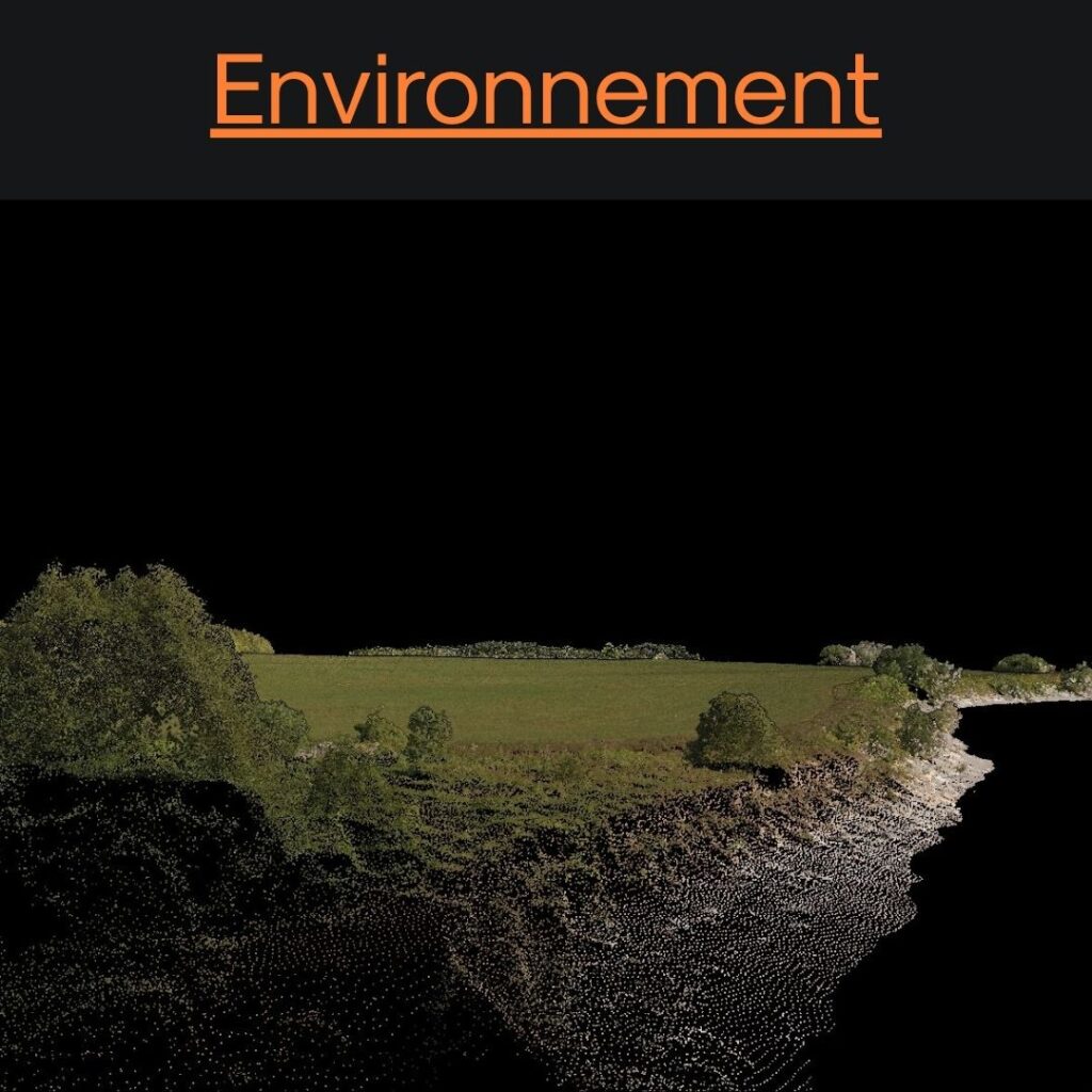
Monitor. Measure. Protect.
Collect high-quality geospatial data across sensitive and remote areas. Generate consistent maps to support environmental assessment, monitoring, and long-term decision-making.
We support our customers in every steps

Chantal Arguin – Groupe Trifide
Land Surveyor and President
Beyond the technological capabilities, we were impressed by the rigour, availability and professionalism of Balko’s team. Their support, from installation to training, was exemplary. Thanks to their expertise, we were able to transform complex data into practical decision-making tools.
Julie Camy – Hydro-Québec
Head of Integrated Expertise in Robotics and Drones
As part of the implementation of our internal drone program, the Balko team played an important role in identifying our needs for power line inspection, guiding us in our technology choices, and using their field experience to advise and train us. Their support helped us structure our practices, train our pilots on the sensor, and ensure a smooth integration of this new tool within our operational processes.

Pascal Chiva-Bernard – ARA Robotics
PDG and Co-Founder
Our collaboration with the Balko team has been both solid and genuinely enjoyable. We are particularly impressed by the Connectiv sensor and how easily it integrates with our platforms. The performance is exactly what we were looking for, and the potential to enhance our operations and the quality of the data we collect is clear. We truly feel we’re working with a trusted partner, both on the human and technical level.