Inspection of power lines by drone, efficient and economical!
Traditional inspection of towers and power lines can be dangerous for workers who have to climb structures or operate aerial work platforms. The use of drones equipped with lidar helps avoid these risks, eliminating the need for physical access to structures at high altitudes.
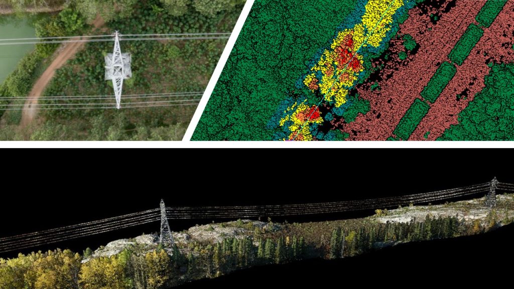
Lidar collects detailed three-dimensional data on towers and power lines. By emitting laser pulses and measuring the time it takes for those pulses to bounce, lidar can provide accurate information about the geometry, topography, and dimensions of structures.
Combined with a high-resolution RGB and thermal camera, our solution is also able to detect defects such as deformations, cracks, offsets and other structural anomalies with high accuracy. It can provide digital terrain models (DTMs) that highlight variations in the shape of towers and power lines, allowing potential problems to be quickly identified.
At the same time, power lines can be prone to problems related to the surrounding vegetation, such as excessive growth of trees and branches. A drone mounted lidar can accurately detect and analyze vegetation, identifying areas where pruning or cutting measures are needed to maintain the safety and reliability of the power grid.
Finally, the data collected by the lidar can be used to assess the condition of pylons and power lines, identify areas requiring special attention and plan maintenance work in a precise and targeted manner. This optimizes resource allocation and reduces costs associated with maintenance.
Courtesy of : MVT GeoSolutions