At Balko Tech, we are proud to announce the addition of the VUX-120 LiDAR module to the Connectiv modular system. This integration further expands the capabilities of our modular approach, offering enhanced precision, flexibility, and efficiency for professionals in surveying, utilities, mining, and beyond. What sets the VUX-120 apart?
What sets the VUX-120 apart?
high-resolutionThe VUX-120 is a high-performance LiDAR sensor designed for UAV-based surveying applications. Its specific characteristics complement our existing offer in more than one way:
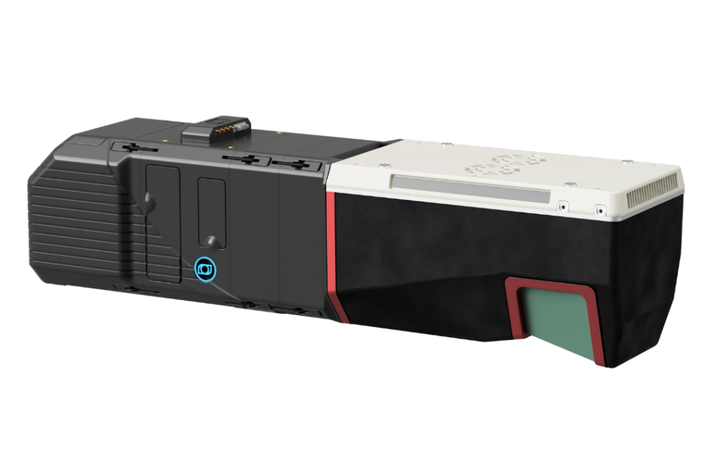
- Ultra-wide field of view: Its 100-degree field of view allows for extensive coverage per pass, reducing flight time and increasing operational efficiency.
- High point density: With up to 2 million measurements per second, the VUX-120 provides exceptionally detailed data for high-resolution mapping.
- Multiple target capability: The sensor can detect and measure multiple return signals per pulse, making it ideal for penetrating dense vegetation and capturing ground data.
- Robust and lightweight design: Optimized for UAVs, the VUX-120 maintains a compact and lightweight build without compromising performance.
A new level of precision
The integration of the VUX-120 within the Connectiv system opens new doors for professionals in multiple industries. It ensures sharp detail in captured data, making it highly reliable for precision-driven tasks, even in challenging environments. Here are some usage examples:
- Utility corridor mapping – Conduct precise aerial mapping of power lines, pipelines, and roadways with superior accuracy, ensuring proactive maintenance and infrastructure management.
- Mining and extraction surveys – Generate high-resolution 3D terrain models to optimize site planning, monitor extraction progress, and enhance safety measures in mining operations.
- Forestry and environmental studies – Penetrate dense canopies to create detailed digital elevation models (DEMs) for biomass assessment, conservation planning, and land management.
Find the perfect camera configuration
The modular nature of Connectiv means the VUX-120 can be paired with various high-resolution cameras to achieve specific project outcomes:
- RGB Cameras – Capture georeferenced images for detailed ortho-mosaics alongside LiDAR data.
- Multispectral Sensors – Enhance environmental and agricultural studies with precise spectral analysis of vegetation health.
- Vertical Camera – Conduct facade inspection and point cloud colorization to analyze structural conditions, detect cracks, erosion, or deformations.
Having the option to swap different imaging solutions with VUX-120, you gain unparalleled versatility to tailor your payload for every mission.
What this means for your Connectiv system
If you already use the Connectiv modular system, the addition of the VUX-120 means:

- Seamless upgrades – Enhance your existing system with minimal effort, ensuring future-proof adaptability.
- Greater ROI – The ability to switch between different sensors and configurations maximizes your investment value and operational efficiency.
- Expanded project scope – With enhanced LiDAR capabilities, you can tackle more complex and data-intensive surveying challenges.
Above and beyond
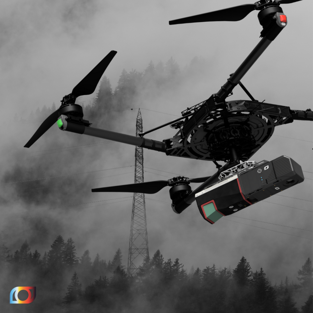
The VUX-120 lightweight and compact design ensures seamless integration with UAVs, optimizing flight efficiency for extended-range missions, like BVLOS. When combined with satellite communication, the VUX120 allows for continuous data transmission and remote monitoring, ensuring reliable performance even in areas without traditional network coverage. With the right drone, you can now reach unthinkable areas, faster and safer.
The VUX-120 elevates the Connectiv system to new heights, delivering advanced precision and efficiency to the industries that rely on high-quality 3D data. Get in touch with our team today to explore how this new integration can empower your workflows and projects.
Other news
Éducation
29 July 2026
Technological sovereignty
Discover why technological sovereignty influences the choice of geospatial solutions in...