
Key Takeways
- Technological sovereignty means maintaining control over a system’s data, software, and architecture.
- Canada is gradually prioritizing Canadian technologies in strategic sectors.
- Technological sovereignty reduces risks associated with critical infrastructure and sensitive data.
- Canadian technology is defined by solutions whose architecture, software, and system integration are controlled in Canada.
A new consideration for geospatial technologies
Technological sovereignty is becoming increasingly important in discussions surrounding geospatial technologies. For a long time, sensor performance, productivity, and ease of use were evaluated, but price generally remained the deciding factor. Today, organizations must also consider where their data travels, who controls the software, and how the overall system is designed. This shift is especially significant in sectors that operate critical infrastructure or strategic territories.
Power grids, pipelines, mines, forests, railway networks, and government facilities generate highly valuable geospatial data. This information supports intervention planning, asset documentation, and decision-making. It also represents strategic intelligence that increasingly requires protection. In this context, technological sovereignty takes on its full meaning.
A gradual evolution in Canada’s approach
Unlike the United States, Canada has not adopted a broad ban on technologies originating from a specific country. Canada’s approach remains pragmatic and primarily risk-based. Recent decisions have focused mainly on critical infrastructure, defence, public safety, and technologies that handle sensitive data. This approach allows requirements to be adjusted according to the context in which a technology is used.
This trend is reflected in several government decisions. Canada has excluded certain suppliers from telecommunications infrastructure, while Ontario recently announced the gradual phase-out of Chinese-made drones from certain sensitive Ontario Provincial Police operations. These decisions do not apply to the entire market, but they demonstrate that technology trust criteria are becoming increasingly important.
Public procurement is accelerating this transformation
Procurement policies are also evolving. The federal Buy Canadian framework increasingly supports domestic industrial capabilities in strategic sectors. Meanwhile, the United States already applies stricter requirements through the National Defense Authorization Act, or NDAA, and various restrictions targeting certain technologies used in government environments.
Although these approaches differ, they share a common objective: reducing the risks associated with technology supply chains. For companies developing geospatial solutions, this evolution points to higher expectations in future procurement processes.
Beyond hardware, the entire technology chain matters
For many years, a product’s country of origin was often the main consideration. Today, organizations are evaluating the entire technology chain. They want to understand how data moves, where it is stored, and who truly controls the system’s operation.
This assessment may include software, firmware, update mechanisms, network communications, cloud services, software libraries, and critical electronic components. It also considers the supplier’s ability to maintain, improve, and support the solution throughout its lifecycle.
This consideration is especially relevant to geospatial technologies. Modern platforms often combine several specialized sensors, inertial navigation systems, embedded software, and advanced processing tools. The value no longer lies only in each component, but in how those components work together.
What does Canadian technology really mean?
In a field as specialized as geomatics, it would be unrealistic to design every sensor locally. The leading LiDAR systems, cameras, and inertial navigation systems are produced by manufacturers located in several countries. This is a natural reality in a highly specialized industry.
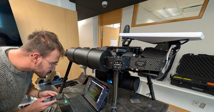
Canadian technology is therefore not defined solely by the origin of each component. It is better defined by control over the system’s architecture, engineering, software, and overall integration. This capability determines how data is acquired, synchronized, processed, and stored.
Balko’s approach: integrating the best technologies within a controlled architecture

At Balko, this philosophy guides the development of the Connectiv ecosystem. Our objective is to integrate the best available sensors to meet the requirements of each geospatial mission. This approach allows users to benefit from the strongest performance offered by each technology within a single platform.
At the core of Connectiv is a central computer designed and assembled in Canada. It serves as the point of convergence for all onboard modules. It synchronizes the different sensors, manages their communications, and records data locally throughout the mission. This architecture helps maintain control over the flow of information from the moment it is acquired.
The platform operates using firmware developed entirely by Balko’s engineering team. This software layer controls communications between the different modules and manages the overall behaviour of the system. Data remains stored locally during operations and does not require a cloud connection for acquisition.
The e-Connect and e-LAS software applications extend this approach. e-Connect is used to configure, synchronize, and monitor the sensor during a mission. e-LAS then supports data processing and georeferencing. When certain BVLOS operations require satellite connectivity, communications can be secured through a virtual private network to protect exchanges between field operations and remote teams.
This architecture was not developed to replace leading sensor manufacturers. It was designed to allow their technologies to operate together within a coherent, controlled environment adapted to professional geospatial missions.
NEXuS reflects the commitment to developing Canadian capabilities
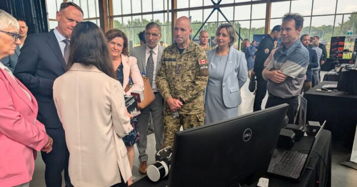
This evolution is also visible in federal government initiatives. The NEXuS Defence Innovation Secure Hub aims to accelerate the development of Canadian technologies related to autonomous and uncrewed systems. It brings together companies, research centres, educational institutions, and government partners to develop strategic capabilities in Canada.
Balko’s participation in this initiative is part of that broader movement. Alongside other Canadian companies, we are contributing to solutions that strengthen national capabilities in geospatial data acquisition, systems integration, and innovation in autonomous technologies.
A shift that will gradually redefine geospatial technologies
Technological sovereignty does not challenge international collaboration or the use of specialized components from leading global manufacturers. Instead, it encourages organizations to better understand the architecture of the solutions they use and identify the elements that truly control their data.
This consideration will increasingly influence public procurement, critical infrastructure, defence, and several industrial sectors. Organizations will seek partners that can demonstrate not only the quality of their sensors, but also control over integration, software, and data management. In a field where geospatial information supports increasingly strategic decisions, this capability will become a major differentiator.
Other news
Education
31 August 2026
LiDAR point clouds: choosing the right density
A LiDAR point cloud is a three-dimensional digital representation of an environment. Each point...