
Key Takeaways
- Drones equipped with LiDAR, thermal cameras, and INS/GNSS systems provide accurate geospatial data to improve wildfire management.
- LiDAR maps forest structure, while thermal imaging detects hotspots and temperature anomalies invisible to the naked eye.
- Drone-acquired data support risk reduction, early fire detection, emergency response operations, and post-fire damage assessment.
- Fusing LiDAR, thermal, RGB, and positioning data provides a comprehensive representation of the landscape in a single mission.
Drones are transforming forest fire management
Drone-based wildfire management has become an essential tool for organizations responsible for protecting landscapes, critical infrastructure, and communities. By combining LiDAR, thermal imaging, RGB cameras, and high-precision positioning systems, drones collect accurate geospatial data that improve risk assessment, accelerate anomaly detection, and support operations before, during, and after a wildfire.
As wildfire seasons become more severe and development continues to expand into forested areas, organizations now have access to technologies that help them better understand the landscape and respond more effectively.
The various technologies integrated into drone platforms contribute to a more proactive approach to wildfire management, while the fusion of multiple sensors delivers significant added value.
Wildfires are natural. Their impact is changing.
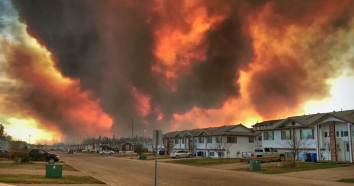
Wildfires play a fundamental role in healthy forest ecosystems. They promote vegetation renewal, recycle nutrients, and enable many plant species to regenerate.
However, the context in which wildfires occur has changed dramatically. Over the past decades, urban expansion into forested environments has created what specialists refer to as the Wildland Urban Interface (WUI). These areas include homes, roads, electrical networks, telecommunications infrastructure, and sometimes industrial facilities located directly adjacent to forests.
At the same time, prolonged droughts, extreme heat events, and increasing fuel availability contribute to more intense wildfires that are more difficult to control.
Today, the challenge extends beyond simply fighting fires. It also involves better understanding the landscape to reduce risks, detect ignitions earlier, and support emergency response teams.
Understanding the different types of wildfires
Response strategies depend largely on the type of wildfire involved.
Ground Fire
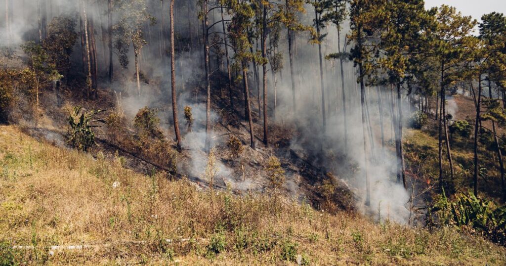
Ground fires, also called zombie fires, burn organic material beneath the surface, including humus, roots, peat, and buried plant debris. They can even remain active during Winter. They are often difficult to detect because they produce very little visible flame while remaining active for several days.
Common indicators include:
- Localized hotspots
- Elevated ground temperatures
- Diffuse smoke
- Vegetation experiencing thermal stress
Surface Fire
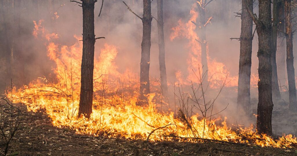
Surface fires account for the majority of wildfires.They primarily consume dry grasses, shrubs, leaf litter, and fallen branches.
Their spread is influenced by several factors, including:
- Fuel load
- Vegetation moisture
- Wind speed
- Terrain slope
Crown Fire
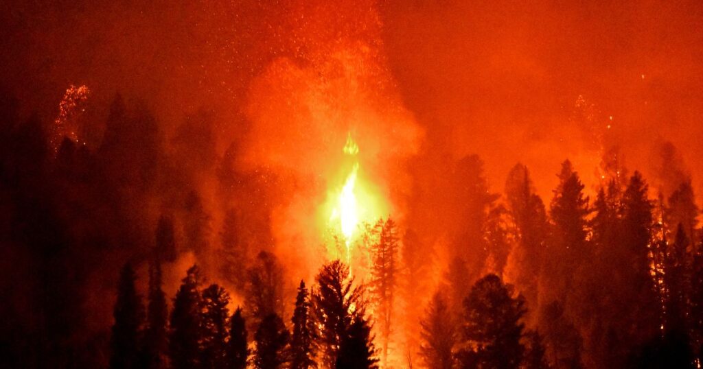
When flames reach the forest canopy, they can spread extremely rapidly from tree to tree. These fires are generally the most difficult to contain.
They are promoted by:
- Dense forest stands
- Dead trees
- Vertical fuel continuity
- Strong winds
- Topography favorable to fire spread
Understanding these fire behaviors helps determine which information should be collected long before a wildfire occurs.
Drones help manage wildfires more effectively
Most wildfires are caused by lightning or human activity. Drones cannot prevent these events. However, they rapidly provide the information needed for better decision-making.
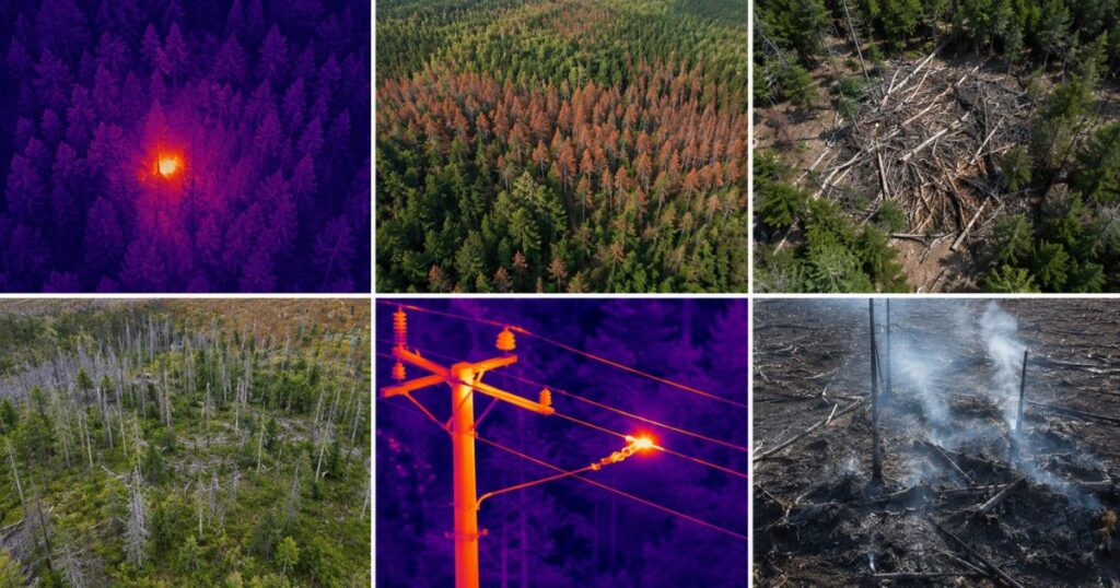
Their contribution can be divided into four primary objectives:
Reduce Risks
Before wildfire season begins, drones help document landscape conditions.
Typical applications include:
- Mapping fuel accumulation
- Identifying dead or declining trees
- Inspecting power lines and other critical infrastructure
- Detecting vegetation under stress
This information supports vegetation management, infrastructure inspections, and proactive mitigation planning.es.
Early Detection
When a wildfire starts, every minute matters.
Drone-mounted sensors can:
- Detect hotspots
- Locate emerging fire starts
- Identify diffuse smoke
- Detect reignition after initial suppression
Earlier detection significantly increases the chances of limiting fire spread.
Support emergency operations
During active incidents, drones provide an up-to-date overview of the affected area.
They can be used to:
- Generate digital terrain models
- Identify access routes
- Monitor fire progression
- Deliver precisely georeferenced observations to field crews
These capabilities improve responder safety while facilitating operational coordination.
Assess Impacts
Once a wildfire has been contained, geospatial data help document its impacts.
Teams can:
- Map burned areas
- Identify residual hotspots
- Estimate affected vegetation volumes
- Plan restoration activities
Why combine multiple sensors?
No single sensor can provide every piece of information required for effective wildfire management. The true value comes from combining complementary datasets.
Thermal Camera
Thermal imaging detects temperature differences invisible to the naked eye. It can identify hotspots, reignition, and overheating equipment that could potentially ignite a wildfire.
LiDAR
Unlike thermal cameras, LiDAR does not measure temperature. Instead, it analyzes the three-dimensional structure of vegetation and terrain.
LiDAR data help:
- Assess forest canopy density
- Map fuel accumulation
- Identify dead trees
- Analyze terrain that may influence fire behaviour
RGB Camera
RGB imagery provides the visual context required to interpret observations. It helps validate anomalies detected by other sensors while improving communication between response teams.
INS/GNSS
All these observations become significantly more valuable when they are accurately georeferenced. Modern inertial navigation systems associate every thermal image, LiDAR point, and RGB photograph with highly accurate positioning data, facilitating field verification and GIS integration.
Data fusion: the real added value
The evolution of geospatial platforms is no longer driven solely by sensor performance, but by their ability to work together.
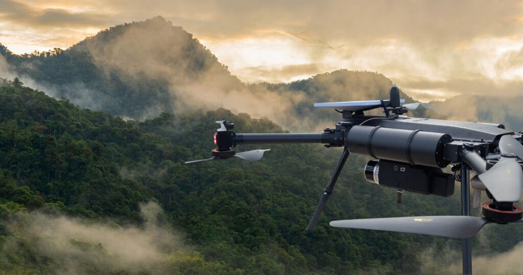
By synchronizing multiple technologies on a single platform, operators can simultaneously acquire LiDAR data, RGB imagery, thermal imagery, and highly accurate positioning information. This integrated approach reduces acquisition time, simplifies data processing, and significantly improves analysis quality.
For organizations responsible for wildfire management, this translates into faster decision-making, a better understanding of the landscape, and more effective coordination among stakeholders.
Technology supporting better decisions
Drones are not intended to replace wildfire crews or emergency response teams. Instead, they provide richer, faster, and more accurate information.
As wildfires become increasingly complex, the ability to acquire and leverage high-quality geospatial data has become a strategic advantage for reducing risk, improving responder safety, and protecting critical infrastructure and communities.
By combining LiDAR, thermal imaging, RGB cameras, and high-precision navigation systems, drones now provide a comprehensive understanding of the landscape that is transforming the way wildfires are managed.
Other news
Education
31 August 2026
LiDAR point clouds: choosing the right density
A LiDAR point cloud is a three-dimensional digital representation of an environment. Each point...